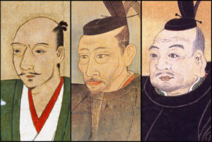
In the eleventh century, Emperor Shirakawa walked the Kumano Kodō nine times. His son Toba walked it twenty-three times. His grandson Go-Shirakawa walked it thirty-three times, often retracing his own footprints into old age. These were not casual journeys. Each Imperial Pilgrimage required hundreds of attendants, weeks of travel from Kyoto, and a route that climbed through some of the steepest forest in Japan.
The road they walked still exists. It runs through the Kii Peninsula in Wakayama Prefecture, lacing together three grand shrines called the Kumano Sanzan, and in 2004 UNESCO inscribed it as a World Heritage site. Only one other pilgrimage in the world shares that status, the Camino de Santiago in Spain, and the two have been formally twinned since 1998. Walk both routes and Tanabe City will hand you a Dual Pilgrim certificate.
I want to take you down that road in this piece, because the Kumano Kodō is older and stranger than its tourist board lets on. It is a thousand-year tangle of Shinto kami, esoteric Buddhism, mountain ascetics in white robes, retired emperors travelling on foot, and a theology that calmly insisted the local gods and the Buddhas of India were the same beings under different masks. You also get a 133-metre waterfall and a torii gate so large it can be seen from across the valley.
In This Article
- What the Kumano Kodō Actually Is
- The Six Routes, In Plain Terms
- The Imperial Pilgrimage and the Numbers Behind It
- The Theology That Made It All Possible
- Kumano Hongū Taisha: The Centre of Gravity
- Kumano Hayatama Taisha: The Coast Shrine
- Kumano Nachi Taisha and the Falls
- The Ant Pilgrimage and the Edo Mass Era
- Yamabushi and Shugendō: The Mountain Side of the Story
- The Yatagarasu: A Three-Legged Crow on Every Banner
- Yunomine Onsen and the Pilgrim Bath
- The 2004 UNESCO Inscription
- How to Walk It Today
- Why It Still Matters
- Tanabe and the Practical Side
- The Pure Land in This World
What the Kumano Kodō Actually Is
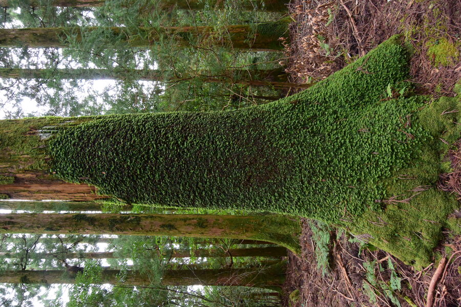
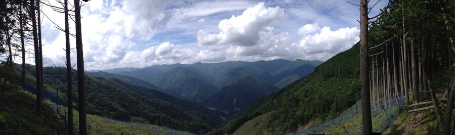
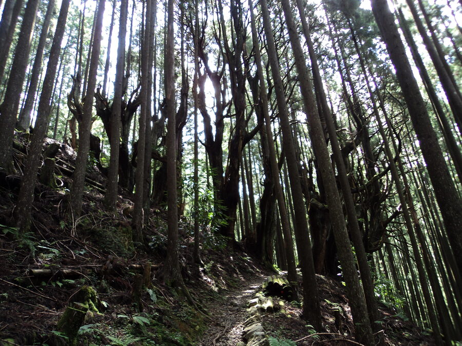
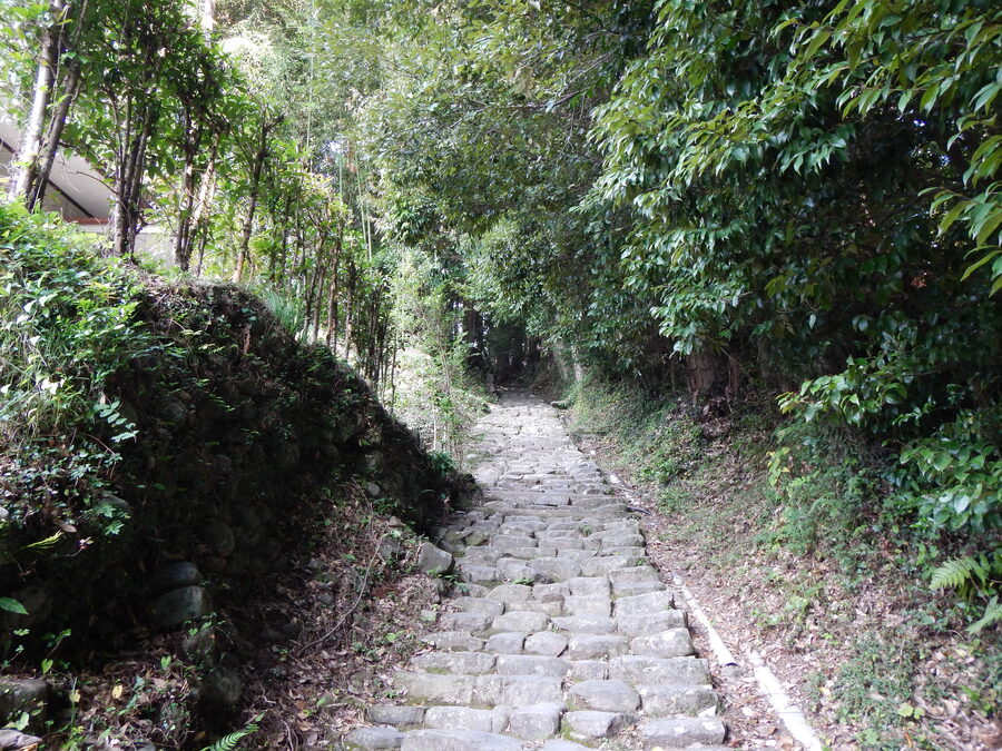
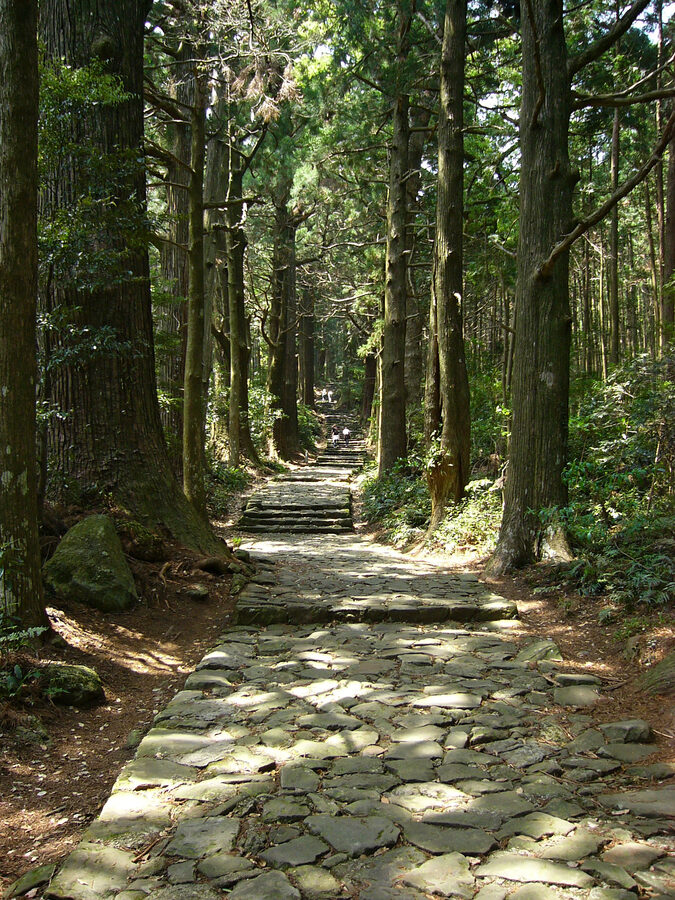
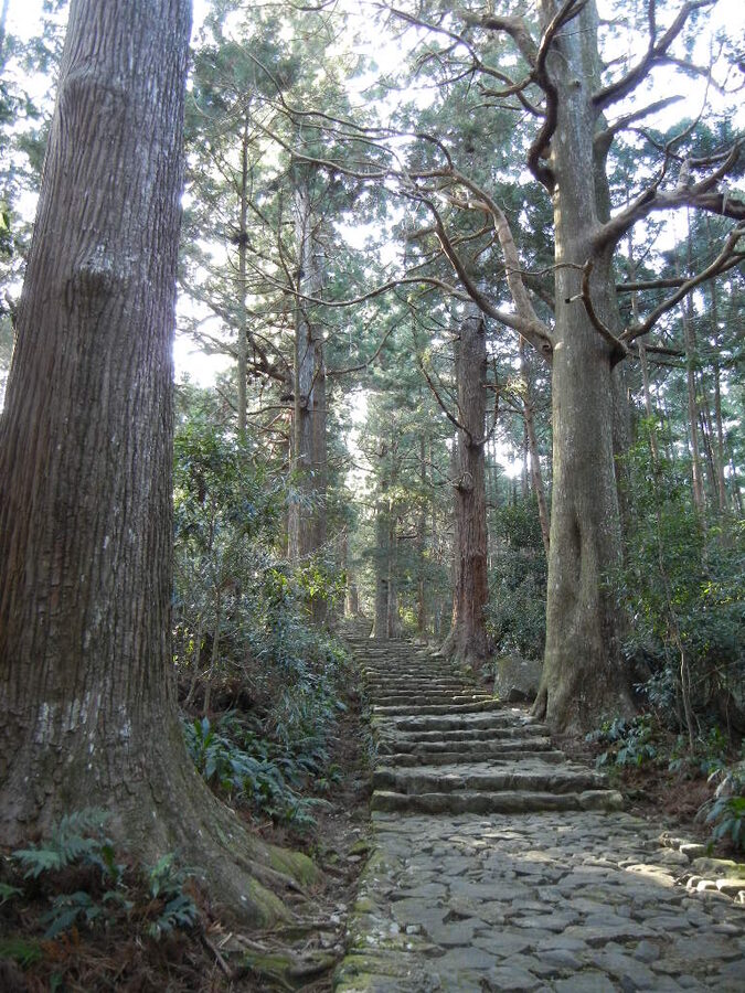
The phrase “Kumano Kodō” (熊野古道, literally “old road of Kumano”) is a collective term, not a single trail. It refers to a network of six pilgrimage routes that all converge on the three grand shrines at the southern end of the Kii Peninsula. The shortest route is around 70 kilometres. The longest comes in at roughly 170. The terrain is mountainous, heavily forested, and laid out as if to deliberately punish anyone in a hurry.
The three shrines themselves are spread out, sitting roughly 20 to 40 kilometres from each other in the wedge of mountains south of Osaka. Kumano Hongū Taisha sits inland near a river junction. Kumano Hayatama Taisha sits on the coast at Shingū, near the river mouth. Kumano Nachi Taisha sits up on a wooded ridge above Nachi Falls, on the Pacific side. Pilgrims have always been expected to visit all three to complete the round.
That basic geometry has been stable since at least the late Heian period, around the year 1000. Some of the roads were already old by then, with archaeological hints of earlier mountain worship reaching back centuries further. By the time the medieval emperors started walking, the route was mature enough to feed, house, and entertain royal processions of three or four hundred people moving at walking pace through the forest.
The Six Routes, In Plain Terms
Six routes feed the Kumano Sanzan, and each one has a personality. If you only ever read about one, it will be the Nakahechi, because it is the route the emperors used and the one most walkers do today. But the others matter, and I want to give you the full set in one place.
The Nakahechi (中辺路) is the classic Imperial route. It starts in Tanabe on the western coast, climbs inland over a series of passes, and arrives at Kumano Hongū Taisha. From there, pilgrims usually pushed on to Hayatama at Shingū and then Nachi. The full Tanabe-to-Nachi traverse is about 70 kilometres of mostly forest path, with traditional inns at the staging points.
The Ōhechi (大辺路) is the southern coastal route, hugging the Pacific edge of the peninsula from Tanabe round to Nachi. It stretches around 120 kilometres and was favoured by Edo-period commoners who wanted to take in the sea views. Long stretches of it have been swallowed by the modern coastal highway and the JR Kisei line, but the surviving sections cross some of the loveliest seaside ridges I have read about anywhere in Japan.
The Kohechi (小辺路) is the steep mountain corridor that links Mount Kōya, the headquarters of Shingon Buddhism, to Kumano Hongū. It runs about 70 kilometres over three passes, each above 1,000 metres. This is the route that physically stitched the esoteric Buddhist world of Kōya to the syncretic Shinto-Buddhist world of Kumano, and any pilgrim wanting both got to walk a brutal piece of trail to do it.
The Iseji (伊勢路) leaves the Ise Grand Shrines in Mie Prefecture and crosses east-to-west to reach Kumano. It runs around 160 kilometres along the eastern coast and through the inland passes. Walking it links the most prestigious Shinto shrine in Japan, Ise, to the most syncretic one, Kumano. That contrast is part of why the Iseji had its own loyal following among Edo-period commoners.
The Kiiji (紀伊路) is the original feeder route from Kyoto and Osaka down to Tanabe. Most modern walkers skip it, since it now runs through suburbs and rice paddy, but in the Heian period this was the section the emperors actually walked first, before they ever crossed into the mountains proper. Without the Kiiji, the others have no front door.
The Ōmineokugakemichi (大峯奥駈道) is the killer of the set. It is the high mountain ridge route used by Yamabushi ascetics from the Yoshino-Ōmine range down to Kumano. It is technically not a pilgrimage road for laypeople at all. It is a training course for mountain monks, a place where the religious value of the road was not “I arrived” but “I survived the walking.”
The Imperial Pilgrimage and the Numbers Behind It
I started with the headline figures because the numbers are the point. Emperor Shirakawa walked the Kumano route nine times. Toba walked it twenty-three. Go-Shirakawa walked it thirty-three. These three retired emperors, all members of the same dynasty across the late eleventh and twelfth centuries, between them made the journey sixty-five times. None of them lived past their early seventies. The pilgrimage was not a one-off bucket list item. It was a recurring civic and spiritual obligation written into late Heian and early Kamakura court life.
The first imperial visit on record is by Emperor Uda, around the year 908. From there the Kumano Goryōji (熊野御幸, “Imperial pilgrimage to Kumano”) evolved into a defined court ritual. A pilgrimage processed at walking pace, with hundreds of porters, court ladies, monks, and guards. Round-trip from Kyoto was roughly a month. Each visit cost a fortune. The records that survive show ordered logistics, fixed prayer stops, and detailed accounts of the offerings made at each minor shrine.
One detail that often gets forgotten is who was on the road. The Kumano route, unlike most other Heian pilgrimage circuits, was open to women, samurai, and commoners as well as the imperial party itself. Women in particular were welcomed, which was rare for a sacred mountain in Japan, where many holy peaks (like nearby Mount Ōmine) banned women outright. That openness is one reason mass pilgrimage took root here so successfully.
The Theology That Made It All Possible
To understand why an emperor would walk for a month, you need the theology. The thing that distinguishes Kumano from almost any other Japanese pilgrimage is its full-bore commitment to honji-suijaku (本地垂迹), the medieval doctrine that local kami were earthly manifestations of cosmic Buddhas. This is the theological move that lets Buddhism and Shinto coexist not as rivals but as the same religion in two costumes.
At Kumano the assignments are explicit. The deity at Hongū is identified with Amida Nyorai, the Buddha of the Pure Land. The deity at Hayatama at Shingū is identified with Yakushi Nyorai, the medicine Buddha. The deity at Nachi is identified with Senju Kannon, the thousand-armed Bodhisattva of compassion. Walking the three shrines, in this framework, is not a tour. It is a doctrinal circuit through the Pure Land, the realm of physical healing, and the realm of compassion, in that order.
This made the pilgrimage spiritually heavyweight in a way no purely Shinto route could match. If you accepted the syncretic logic, finishing the Sanzan circuit got you a personal audience with Amida Buddha himself at Hongū, after which you were essentially considered redeemable. By the late Heian period, Kumano had picked up the nickname “the Pure Land in this world.” Pilgrims who died on the route were thought to die in a state of grace.
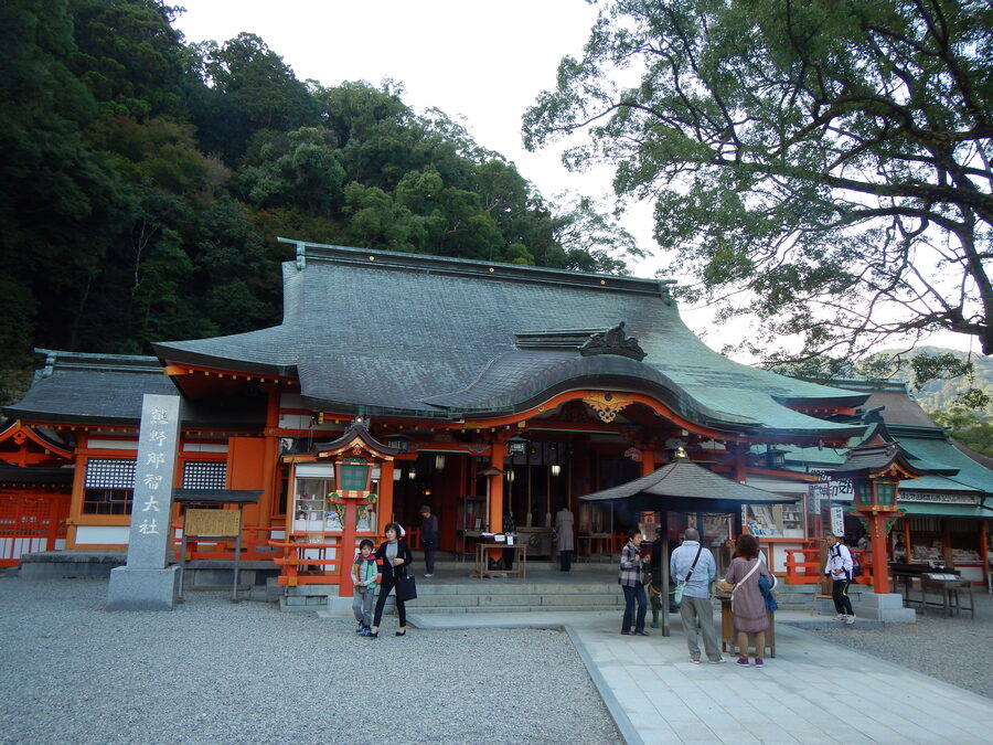
Kumano Hongū Taisha: The Centre of Gravity
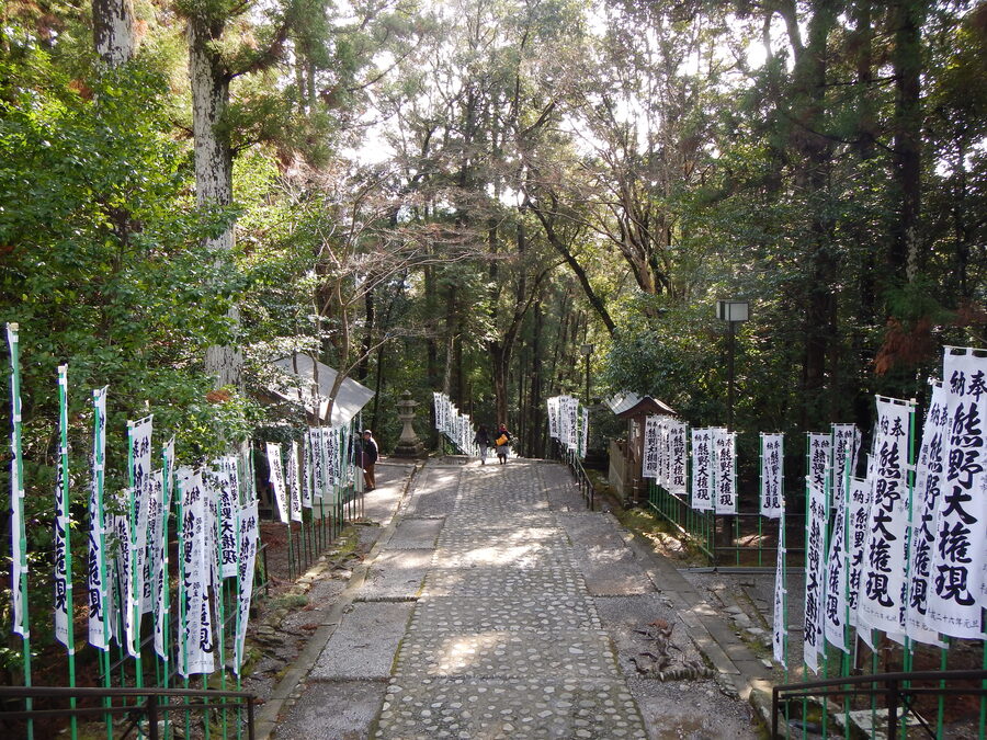
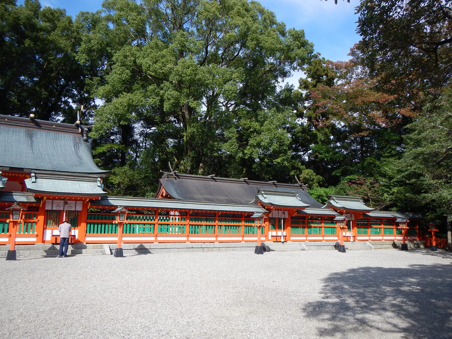
If you only have time to visit one of the three shrines, you go to Hongū. It is the central node, the destination of the Imperial pilgrimage and the modern Nakahechi alike. The current shrine sits on a wooded hillside in Tanabe Municipality, Wakayama, and is a quiet, low, dark-wood compound that does not announce itself.
That quietness is partly an accident of history. The original Hongū did not stand here. It stood on a sandbank a kilometre downstream, at a place called Ōyunohara (大斎原), where the Kumano River meets the Otonashi River. In 1889 a massive flood swept through the valley and partly destroyed the old shrine. Rather than rebuild on the same vulnerable spot, the priests moved the surviving pavilions to higher ground in 1891. Of the original five main pavilions, only three were rebuilt at the new site.
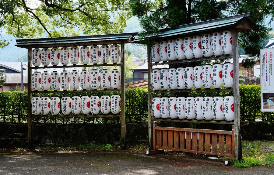
You climb a long flight of cedar-lined stone steps to reach the modern shrine. The stairway is set under huge trees, and the lanterns lining the route still carry the names of the pilgrim associations who paid for them. There is no shop selling tickets. There is no entrance gate, in the modern sense. The shrine simply opens at the top of the stairs, and the closest most pavilions allow you is a wooden veranda with a pebble courtyard in front.
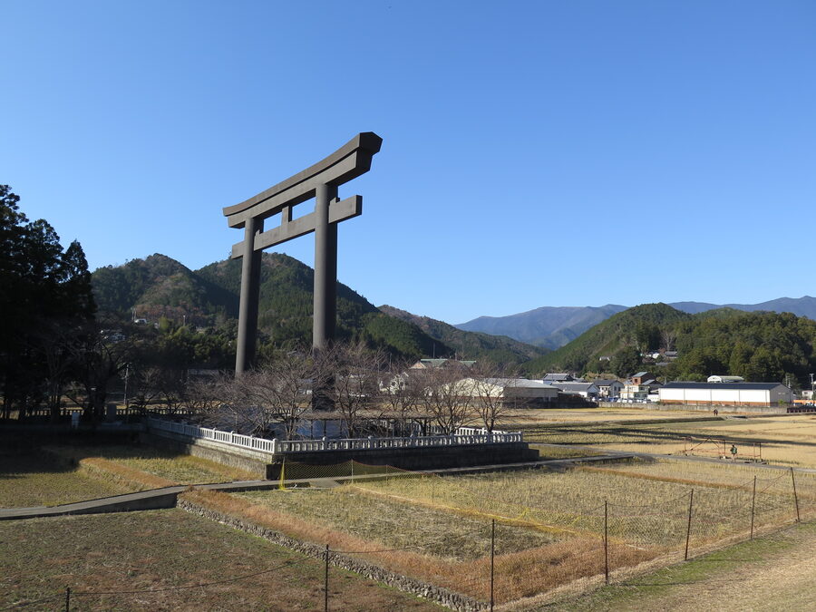
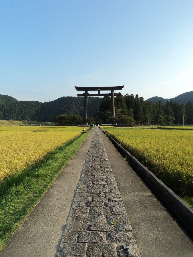
Despite the Meiji-era move, Ōyunohara still matters. In the year 2000 a 33.9-metre-tall, 42-metre-wide steel torii gate was erected on the original sandbank to mark where the old shrine stood. It weighs 172 tons and is the largest torii in the world. You can see it from across the valley as you descend the Nakahechi route, and it functions as a sort of distant landmark for pilgrims still arriving on foot.
Kumano Hayatama Taisha: The Coast Shrine
Hayatama sits on the Pacific coast at Shingū, where the Kumano River reaches the sea. The shrine compound itself is brisk and bright, painted in the vermilion that you do not see at Hongū. Hayatama enshrines Kumano Hayatama no Ōkami, identified in honji-suijaku terms with the Buddha Yakushi Nyorai, the cosmic physician.
The defining living object at Hayatama is a sacred Nagi tree (Nageia nagi), said to be around 1,000 years old. It is the largest of its species in Japan. Pilgrims have for centuries plucked a leaf from the Nagi to carry as a charm against sea storms. The tree is now fenced off and you cannot pluck anything, but the practice tells you something about how locked-in the local sea-faring economy has been with this shrine for a millennium.
There is a sister site you should not miss while in Shingū. Up on the slope above the modern shrine sits Kamikura-jinja, where a vast leaning rock called Gotobiki-iwa is treated as the original landing place of the Kumano kami. To reach it you climb 538 stone steps. The local fire festival, the Otōmatsuri, runs every February with men in white linen carrying flaming torches up and down those steps. It is not a tourist event. It is one of the most physically dangerous shrine festivals still performed in Japan.
Kumano Nachi Taisha and the Falls
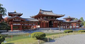
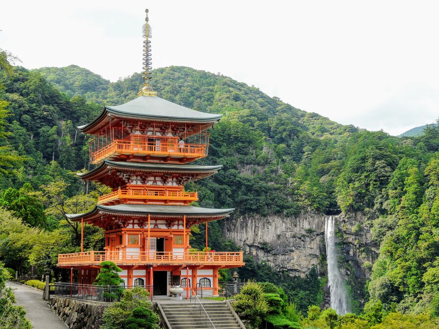
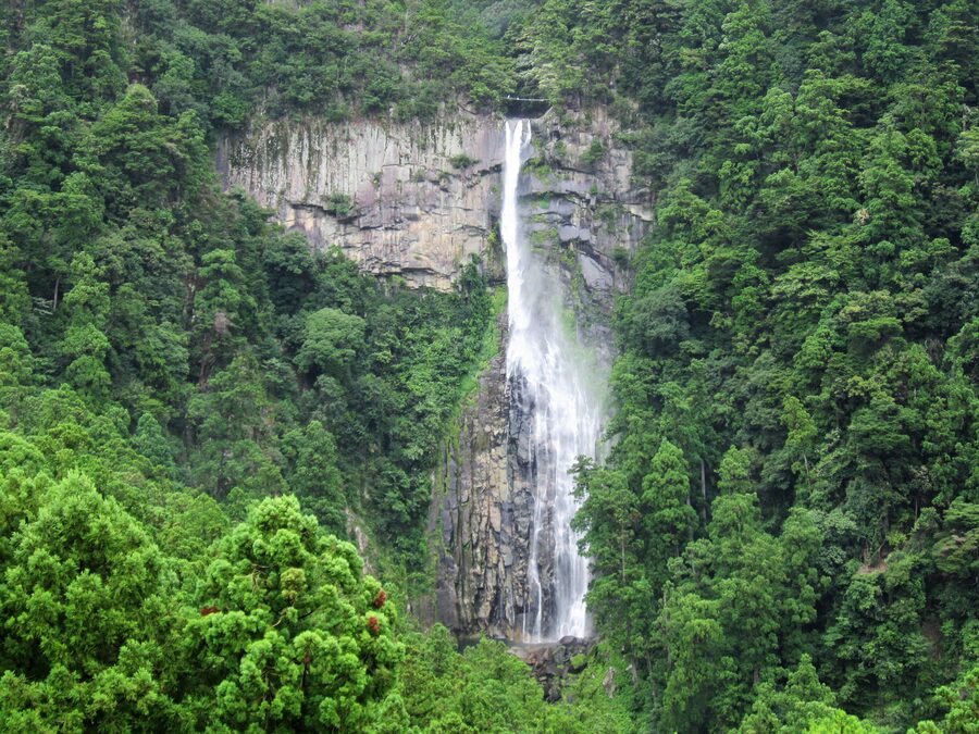
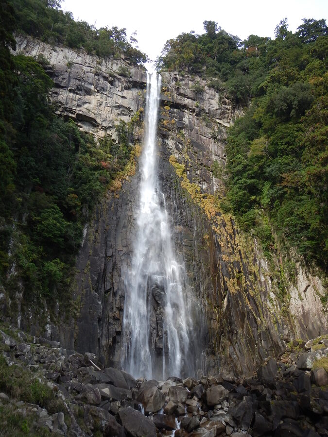
The third shrine, Kumano Nachi Taisha, is the one with the iconic photograph. You have seen it. A vermilion three-storey pagoda in the foreground, a 133-metre waterfall behind. That pagoda belongs to Seiganto-ji, a Buddhist temple. The shrine itself is a few minutes walk away through the woods. The composition you see in every guidebook is not actually of the shrine at all, but of the temple-and-waterfall pair, with the shrine off-frame.
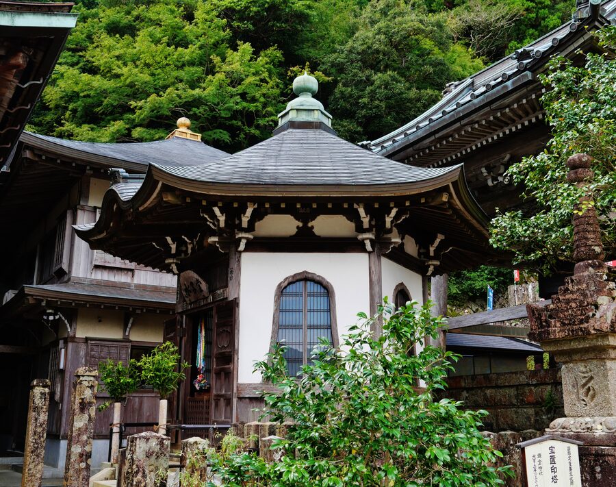
That accidental fact tells you everything about Kumano theology. Seiganto-ji and Nachi Taisha grew up alongside each other for over a thousand years and were treated, doctrinally, as parts of the same religious institution. The 1868 Meiji order to forcibly separate Shinto and Buddhism (shinbutsu bunri) hit Kumano hard. Many smaller temple buildings were demolished. Seiganto-ji survived because its main hall was old, important, and physically intertwined with the shrine compound.
The deity at Nachi is identified in honji-suijaku terms with Senju Kannon, the thousand-armed Kannon. The waterfall itself, Nachi-no-Taki, is treated as the body of a separate but related kami called Hiryū Gongen, “the Flying Dragon Manifestation.” Hiryū has its own small shrine, Hirō Jinja, at the foot of the falls. A Shinto priest still makes daily offerings to the waterfall in person, in a ritual that has not visibly changed in style since the early medieval period.
The Ant Pilgrimage and the Edo Mass Era
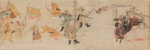
By the late medieval period the imperial monopoly on Kumano pilgrimage was breaking apart. After the Heian period closed and the Kamakura shogunate took power, the imperial purse could no longer afford monthly month-long royal walks. But the religious infrastructure stayed. Monks, priests, and innkeepers along the route had to find new clientele, and they found it in the warrior class, the merchant class, and finally the rural commoners.
The historical phrase you will see, especially for the Muromachi (1333-1573) and Edo periods, is ari no Kumano mōde (蟻の熊野詣), “the Ant Pilgrimage to Kumano.” It captured the visual reality of the time: the road was so saturated with walkers that, seen from a hillside, the line of pilgrims looked like a column of ants. By the Edo period, the inns at the major rest stops were taking up to 800 guests a night.
The Ant Pilgrimage was driven by something close to religious populism. The Pure Land theology that had let aristocrats imagine themselves redeemed at Hongū was now being preached to peasants by a network of oshi, regional Kumano agents who travelled out from Wakayama to tell villages about the route, raise donations, and arrange group walks. By the seventeenth century, large parts of rural Japan had a relationship with Kumano even if no one in the village had ever been.
One reason commoner pilgrimage worked so well was that Kumano fitted the rhythms of farming. You walked in the slack months between harvests. You went in groups that pooled funds, an early form of religious credit union called a kō. The road provided a controlled, semi-supervised release valve, and the Tokugawa government, which carefully regulated travel for political reasons (see how I wrote about sankin-kotai and Edo travel control) was generally willing to let religious pilgrimage continue when other movement was restricted.
Yamabushi and Shugendō: The Mountain Side of the Story
You cannot tell the Kumano Kodō story without the Yamabushi (山伏), the mountain ascetic monks who treated the high ridges of the Kii peninsula as a training ground. The discipline they practised is called Shugendō (修験道), “the way of testing the powers.” It blends esoteric Tantric Buddhism, Shinto kami worship, and Daoist longevity practice into a single mountain path.
The Yamabushi route through Kumano is the Ōmineokugakemichi I mentioned earlier, the high ridge from Yoshino down to Hongū. It is brutal terrain. The full traverse is about 100 kilometres of broken ridge, with overnight camps in the open and a list of fixed ritual sites along the route, each tied to a specific austerity practice. Modern Yamabushi still walk it, mostly as members of organised lineages from Kinpusen-ji at Yoshino or Shōgo-in in Kyoto.

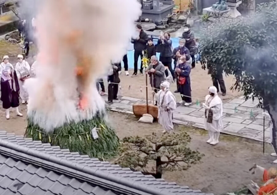
The defining Yamabushi public ritual is the saitō goma (柴灯護摩), the open-air fire ceremony. Wood is built into a tall pyramid, sutras are intoned, and the whole structure is set ablaze while attendant monks throw in prayer-tablets. The fire is supposed to convey the wishes of the laity to the cosmic Buddhas via the ascending smoke. I find it visually closer to a Vedic Indian ritual than to anything else in Japanese religion, which is partly the point. Shugendō is an Indian-Chinese-Japanese pile-up.
The Yamabushi practice has parallels with other Japanese spiritual disciplines that channel the body into ritual action, the way tea ceremony under Sen no Rikyū turned hospitality into meditation. Kumano religion has always been about doing rather than reading. You walk the road. You stand in the waterfall. You burn the fire. The texts come second.
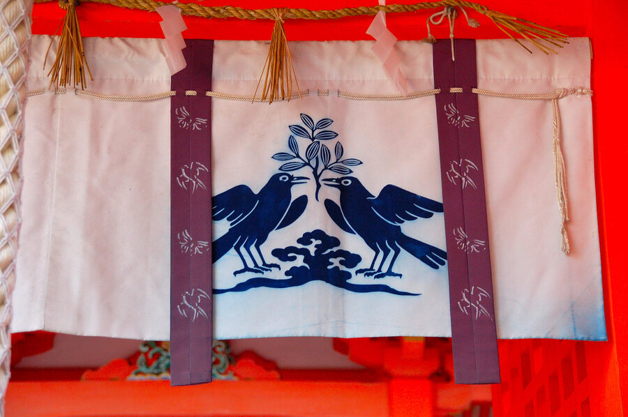
The Yatagarasu: A Three-Legged Crow on Every Banner
Walk the route and you will see one symbol everywhere: a black three-legged crow called the Yatagarasu (八咫烏). It appears on signs, on banners, on every shrine seal, and on the modern Japan Football Association crest. The Yatagarasu is the divine crow that, according to the Kojiki and Nihon Shoki, was sent by the gods to guide the legendary first emperor, Jimmu, through the Kii Mountains on his eastward conquest. He had been lost. The crow led him out.
This is the founding myth that anchors the whole Kumano region in the early imperial story. By honouring the Yatagarasu, the shrines effectively claim that the imperial line itself owes its survival to a Kumano-area divine intervention. That mythological link is a big part of why later emperors took the pilgrimage so seriously. They were not visiting strangers. They were walking back to a place their ancestor had been rescued.
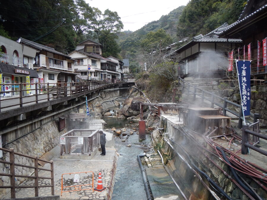
Yunomine Onsen and the Pilgrim Bath
One stop you should know about is Yunomine Onsen, a tiny hot spring village a short bus ride from Hongū. It claims to be the oldest known onsen in Japan, with a documented history of around 1,800 years. For Kumano pilgrims it had a specific function: ritual purification before the final approach to Hongū Taisha. You arrived dirty, mountain-stained, and exhausted, and you bathed yourself clean before presenting yourself at the shrine.
The famous fixture at Yunomine is the Tsuboyu (つぼ湯), a tiny wooden bathhouse over a single rock pool, big enough for two people, set on a stream in the middle of the village. Yunomine pilgrims took turns booking thirty-minute slots in it. The Tsuboyu is the only registered World Heritage hot spring on Earth, on the basis that it is part of the ritual purification system of the inscribed pilgrimage route.
The 2004 UNESCO Inscription
The Kumano Kodō was inscribed on the UNESCO World Heritage list in 2004 as part of a larger property called “Sacred Sites and Pilgrimage Routes in the Kii Mountain Range.” The inscription bundled three connected centres: the Kumano Sanzan with its routes, Mount Kōya (Kōya-san) with its Shingon Buddhist headquarters, and Yoshino-Ōmine with its Shugendō and cherry-blossom mountains.
The inscription is significant for two reasons. First, it was the first time in Japan that a road, as opposed to a building or a site, was registered as World Heritage. The pilgrimage paths themselves, as physical infrastructure, were the heritage. Second, only one other pilgrimage route on Earth shares this status, Spain’s Camino de Santiago de Compostela. In 1998 Wakayama Prefecture and the regional government of Galicia signed a sister-road affiliation. Pilgrims who complete both Kumano and Camino can register at the Tanabe Tourism Bureau and receive a Dual Pilgrim certificate.
The Camino-Kumano comparison is more than a marketing trick. Both are over a thousand years old, both involve a long forested approach, both end at a major shrine or cathedral, and both have survived as living religious institutions through repeated state interference. The Camino was nearly wiped out by the Reformation; Kumano was nearly wiped out by Meiji shinbutsu bunri. Both came back.
How to Walk It Today
Most modern walkers do the Nakahechi, since it is the easiest to access and has the densest traditional inn infrastructure. The standard package is a four-day or five-day walk from Takijiri-ōji (the official trailhead near Tanabe) to Hongū, with optional bus connections to Hayatama and Nachi at the end. You can do shorter day-walks, the most popular being the Daimonzaka cedar climb up to Nachi.
The Tanabe Kumano Tourism Bureau is the institutional engine of the modern revival. They were the originators of the Dual Pilgrim certificate, the bilingual signage, and the booking system that lets foreign visitors reserve traditional minshuku inns directly. Without them, the route would not be the international pilgrimage it has become.
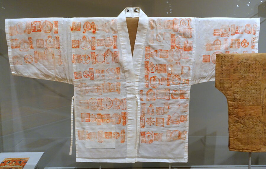
If you walk it, carry a gōinchō (御印帳), the small folding stamp book sold at the major shrines. At each shrine and major oji you collect the resident calligraphic stamp. The book is a memory artefact and a proof-of-pilgrimage object at the same time, a direct descendant of the Edo-period stamped pilgrim jacket I showed you earlier.
Why It Still Matters
Kumano survived a lot. It survived the Imperial monopoly of the Heian, the warring-states chaos of the Sengoku, the regulated peace of the Edo era, the violent religious purges of the early Meiji, and the road-building modernisation of the twentieth century when most of the original Kiiji and Ōhechi got paved over. What is left, today, is the part that was too high or too remote to bulldoze, mostly the Nakahechi and the Kohechi spine.
That survival is partly luck and partly the structure of Kumano itself. Because the road was the pilgrimage, not just the means to it, sufficient stretches of trail had to remain walkable for the religion to function. Tear up the path, and the Kumano religion as a thousand-year practice ceases to exist. The 2004 UNESCO inscription locked that in legally; the 1998 Camino sister-pact locked it in internationally; the Tanabe Tourism Bureau locked it in commercially.
I think the most interesting parallel for an English-language reader is not actually Spain. It is closer to home, in the way that Toyokawa Inari built a Japanese pilgrimage practice out of dual Buddhist-Shinto coexistence, or how Sen no Rikyū built tea practice into a meditative path. Kumano is bigger and older than either, but the underlying logic is the same: walk the road, do the ritual, become someone slightly different at the other end.
Tanabe and the Practical Side
Tanabe is the western anchor of the whole network. It is the modern transport hub, with Kii-Tanabe station on the JR Kisei line, and it is where the Tanabe Kumano Tourism Bureau keeps its office. Almost every overseas-organised Kumano walk starts here, and you can buy your gōinchō, your bilingual route map, and your bus pass from a single counter near the station.
The town has an additional layer of history that I am fond of. Morihei Ueshiba, the founder of Aikidō, was born here in 1883. He grew up in the same hills that the medieval pilgrims crossed, and the Aiki tradition he later founded reflects a mountain-religion influence in its emphasis on Shintō purification, breath-work, and circular movement. If Aikidō ever feels too abstract in a dōjō, walking the Nakahechi may be the practical shortcut to seeing where its body language was originally formed.
Tanabe is also where you fall back to if you want a coastal break. The local seafood is excellent, the public garden walks are lovely, and the surrounding bay is one of the nicer minor stretches of Wakayama coast. If you have read my piece on Japan’s greatest gardens, you will recognise the regional aesthetic of the Tanabe area, restrained, watery, and emphatically not a Kyoto-style perfection. It is a working coastal town that happens to have a UNESCO trail starting from its outskirts.
The Pure Land in This World
I want to close on the phrase the medieval pilgrims used for Kumano, genze no jōdo (現世の浄土), “the Pure Land in this world.” That phrase, in a Buddhist context, is a paradox. The Pure Land is by definition somewhere else, a paradise outside this realm, where Amida Buddha dwells. Calling Kumano the Pure Land in this world is theologically pushy. It says: this place, this forest, this wet stone path, is already paradise. You do not need to die first.
That claim is still embedded in the route. You can walk it as exercise, as cultural tourism, as photography, as a Camino-style spiritual experiment. None of those frames are wrong. But the Heian and Kamakura belief that the road itself was already the destination is what kept the trail in active use for a thousand years, and it is what UNESCO eventually registered. Kumano is not a road to a sacred place. The road is the sacred place.
Walk it once and you will see why the emperors kept coming back.