The age in which Japan learned to farm, somewhere between six and twelve centuries long depending on whose dates you trust, is named after a word carved on a garden stone by the father of the last shogun. In the third month of 1828 Tokugawa Nariaki, then a younger son of the Mito house and a year away from becoming its lord, put up a stone in his family’s Edo residence on the Mukōgaoka heights and covered it with his own calligraphy. One word in it was yayoi, the old name for the third month of the lunar year, the month of new growth. When the new Meiji government drew up ward names in 1872, the clerks are said to have taken that word for the new district of Mukōgaoka Yayoi-chō, and in 1884 three young men from the university next door found a pot there.
That pot gave its name to a pottery style, the pottery gave its name to a culture, and the culture gave its name to the age in which rice paddies, bronze, iron, moated villages, organised killing and the first Japanese kings all arrived. Nobody can say now exactly where on the hill the pot came out of the ground. I find that a fitting start for a period whose beginning has moved by five hundred years in my own adult lifetime, and whose end merges into the sealed tomb at Hashihaka. This is how Japan became a country of rice farmers, and it ends, as everything on this site does, with the places where you can still stand in it.
In This Article
- A pot, a street and a five-hundred-year argument
- The Rekihaku redating
- The first paddies: Nabatake and Itazuke
- Who brought the rice
- Bronze, iron and a hillside of swords
- Dōtaku: bells nobody remembered
- Kōjindani’s 358 swords
- Iron, and who controlled it
- The war that came with farming
- Moats, stakes and hilltops
- Yoshinogari
- A gold seal from the emperor of Han
- Found under a stone on Shikanoshima
- A hundred countries and a queen
- Where to see the Yayoi period today
- Yoshinogari Historical Park, Saga
- The gold seal: Fukuoka City Museum and Shikanoshima
- Itazuke and Nabatake
- Toro, Shizuoka
- The Izumo bronzes: Shimane Museum of Ancient Izumo
- Yayoi-chō, Tokyo: where the name came from
A pot, a street and a five-hundred-year argument
The finders, on 2 March 1884, were Arisaka Shōzō, then a student at the university’s preparatory school, and his friends Tsuboi Shōgorō and Shirai Kōtarō. They were poking about a shell midden on the edge of the plateau above Nezu when Arisaka picked out a round-bellied jar, its neck broken off, that looked nothing like the cord-marked Jōmon pottery everyone already knew. By 1896 the type was in print as Yayoi-shiki doki, “Yayoi-style pottery”, and the -shiki survived until the archaeologist Sahara Makoto argued in 1975 that a “style” suffix made no sense on the name of an era.
Arisaka’s memory of the spot faded with each retelling, and by 1923 he was writing that houses covered the hill and the place could no longer be found. The best candidate is on the University of Tokyo’s Asano campus, where children picking up sherds under a fallen tree led to a dig in 1975 that found a ditch, a layer of oyster shells and five more Yayoi pots. It became the national historic site of Yayoi 2-chōme in 1976, and the original jar, now an Important Cultural Property, stays in the University Museum and is almost never on show.
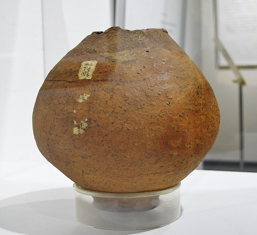
There is a final twist that I enjoy. Specialists in Kantō pottery now argue over whether the 1884 jar is late Yayoi at all, and some place it in the early Kofun period. The pot that named the age may not belong to it.
The meaning of the name has moved too. For decades “Yayoi” meant simply “the time when Yayoi pottery was used”, until the digs at Karako in Nara in 1936 and 1937 turned up farming tools beside the pots and Toro in Shizuoka produced the first excavated Yayoi paddies after 1947. Most Japanese archaeologists now define the period as the age from the beginning of food production to the appearance of the keyhole-shaped tomb.
The Rekihaku redating
Then came the dates. In May 2003 a team from the National Museum of Japanese History in Sakura, known to everyone as Rekihaku, presented accelerator radiocarbon dates on the soot and charred food crusted onto the oldest Yayoi cooking pots of northern Kyushu. Harunari Hideji, Fujio Shin’ichirō, Imamura Mineo and Sakamoto Minoru put the start of the Initial Yayoi at around the 10th century BC, roughly five hundred years earlier than the 5th or 4th century BC then in Japanese textbooks.
Their later work put the Early Yayoi at about 800 BC, the Middle at about 400 BC and the Late at about AD 50, while leaving the end, in the middle of the 3rd century AD, where it was. Fujio’s refinement puts the first irrigated paddies of northern Kyushu at around 930 BC.
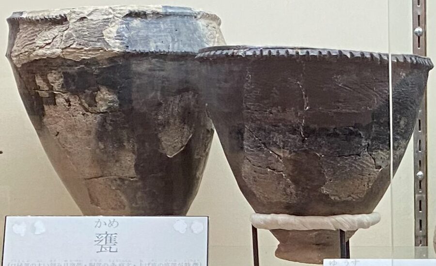
English-language accounts still mostly give the old round figure of 300 BC to AD 300; Japanese sources now commonly give the 10th, or the 9th to 8th, century BC for the start. The difference is not pedantry. Rice was supposed to have crossed the sea with refugees from China’s Warring States, and on the new dates it arrived instead around the fall of the Shang and the rise of the Western Zhou, as Harunari himself pointed out.
Not everyone accepted it. Iwanaga Shōzō of Kyushu University published a sharp critique in 2005, and his colleague Miyamoto Kazuo argues for a start in the 8th century BC, working from the dating of bronze daggers in Korea and Liaoning. The technical objections are real: soot from pots that boiled fish or shellfish can carry old marine carbon and read too early, and the calibration curve runs nearly flat between about 800 and 400 BC, so dates in that stretch smear across centuries.
My view is that the old date was always suspiciously tidy, and that a slow, staggered arrival fits everything else the ground has produced. In April 2023, twenty years after the announcement, the long chronology reached Japanese high-school textbooks. It has one comic side effect: on Rekihaku’s numbers, the paddies of northern Kyushu are some 250 years older than 660 BC, the date the Nihon shoki of 720 gives for the founding of the country by the first emperor, Jinmu.
The first paddies: Nabatake and Itazuke
The story of the paddies begins with a tailor. In January 1950 Nakahara Shigeaki, who kept a tailor’s shop by Takeshita Station in Fukuoka and spent his free time hunting pottery, picked up two kinds of sherd lying together in a burdock field at Itazuke: one of the Yūsu type, then classed as final Jōmon, and one of the Itazuke I type, then classed as the earliest Yayoi. Four years of digging followed, and found a moated village, its ditch V-shaped in section and egg-shaped in plan, 110 metres by 81, with more than two hundred storage pits for grain.
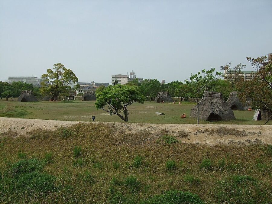
The bigger shock came in 1978. Below the earliest Yayoi layer, in soil that should have been Jōmon, city archaeologists found paddies with a main canal, weirs, inlets and outlets, footprints, wooden hoes and stone reaping knives. Wet-rice farming was older than the pottery that was supposed to define it.
Nabatake, in Karatsu on the Saga coast, pushed the line back again. Found in 1979 and dug in 1980 and 1981, it had paddies associated with Yamanotera-type pottery, older than Yūsu: four little fields totalling about 18 square metres, with channels, a weir and banks built from stakes and boards. About 250 carbonised grains came out, more than a hundred of them identified as japonica, and the calibrated radiocarbon age is around 930 BC.
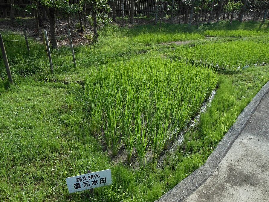
What strikes me about both sites is that the package arrived complete. There is no clumsy experimental phase in the ground: the first paddies already have irrigation, levelled plots, banks, polished stone tools for clearing and harvesting, and wooden spades and hoes shaped for wet soil. Yayoi paddies were a mosaic of small plots, some no bigger than five square metres, which made levelling easy on uneven ground.
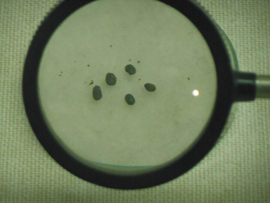
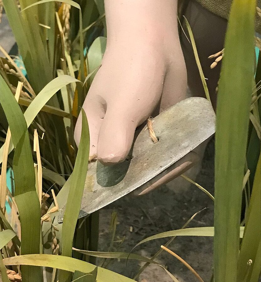
The harvest was taken ear by ear. The ishibōchō, a polished stone reaping knife shaped like a half-moon with two holes for a finger loop, cut the heads off the ripe stalks one at a time. Grain went into flask-shaped storage pits at first, and from the Middle Yayoi into raised-floor granaries on posts.
On Rekihaku’s chronology the spread east was slow. Rice took about 250 years to move beyond northern Kyushu, reached the Kawachi plain near Osaka somewhere between 750 and 550 BC, stalled around Ise Bay in the 6th century BC, and reached the western Kantō only in the 3rd century BC, apparently with settlers from the Kinki region.
The far north is the strangest case. Paddies appear at Sunazawa near Hirosaki in Aomori in the 4th century BC and at Tareyanagi in the 3rd, and then the north gave rice up and went back to hunting, fishing and gathering for centuries. Neither Hokkaido nor the Ryukyu Islands took up paddy farming in this period; their people carried on in what archaeologists call the Epi-Jōmon and Shell Midden cultures, and the line from Hokkaido’s Epi-Jōmon leads in time to the Ainu. The terraced paddies you see today at places like Senmaida on the Noto Peninsula are distant descendants of all this, built many centuries later; Yayoi farmers stuck to wet lowlands and valley floors.
Who brought the rice
Rice was domesticated in the Yangtze valley, and the argument in Japan is about the last leg. The mainstream archaeological view runs from the Yangtze north to Shandong, across to the Korean peninsula and down to northern Kyushu. The agronomist Andō Hirotarō argued for a direct crossing of the East China Sea, and the folklorist Yanagita Kunio, in the essays collected as Kaijō no michi (The Road Over the Sea), imagined rice coming up the chain of southern islands.
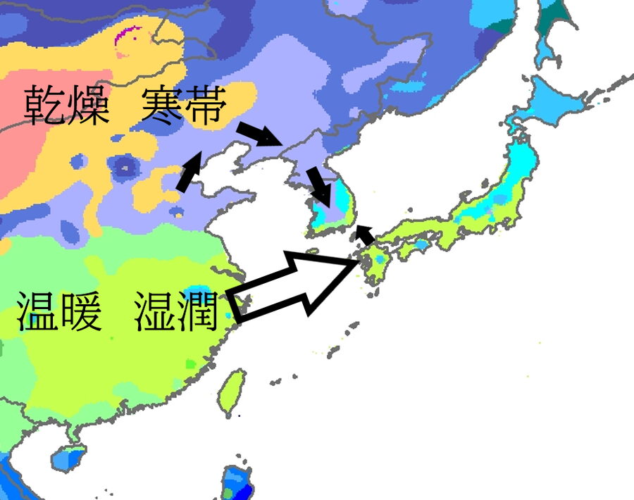
Archaeology has been unkind to Yanagita: there is no rice in Okinawa until the Gusuku period, a thousand years and more after Nabatake. The Korean evidence, on the other hand, is everywhere. Bounded paddies, polished stone tools, wooden farming implements, ditched settlements, domestic pigs, a round house type first identified at Songguk-ri in South Chungcheong, and the dolmen burials of the Itoshima coast all have close counterparts in the southern peninsula’s Mumun culture.
The harder question is who the farmers were. In the 1950s the anatomist Kanaseki Takeo dug the dune cemetery at Doigahama in Yamaguchi, where shell lime in the sand had preserved more than three hundred skeletons, and found people quite unlike the Jōmon: men around 163 centimetres, three to five taller than their Jōmon predecessors, with long, flat faces. He concluded that migrants from the continent had married into the native population; his rival Suzuki Hisashi argued that a new diet and way of life had changed the local people’s bodies instead.
Hanihara Kazurō’s “dual structure model” of 1991 set the terms most textbooks still use: a Jōmon population overlaid in the west by continental migrants who spread east and mixed, leaving the Ainu in the north and the Okinawans in the south closest to the original stock. Hanihara thought population growth was too fast to explain without something like a million migrants. The longer Rekihaku chronology took the air out of that, because given five or six more centuries, ordinary growth does the job.
What the cemeteries show is a slow takeover rather than a conquest. At the dolmens of Shinmachi in Itoshima, a burial type straight from Korea, a skeleton found in 1986 had had teeth deliberately removed in the old Jōmon fashion, and in early northern Kyushu Jōmon-type skeletons at first outnumber those with continental features. Within a few centuries the balance had reversed. The demographer Koyama Shūzō’s widely quoted estimates put the population of the archipelago at roughly 76,000 at the end of the Jōmon and nearly 600,000 by the end of the Yayoi, and the farmers’ children account for most of the difference.
Ancient genomes have since told much the same story. Studies of Jōmon DNA put the Jōmon share in the average mainland Japanese genome at somewhere between a tenth and a fifth, higher among Okinawans and much higher among the Ainu, and a 2021 study argued for a third wave of continental ancestry in the Kofun period. Many linguists also tie the arrival of the Japonic languages to these farmers. The people they met, and what those people had already built, belong to the sister article on the Jōmon period.
Bronze, iron and a hillside of swords
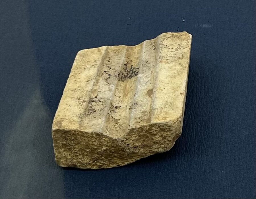
Bronze arrived at the end of the Early Yayoi, from the peninsula, and northern Kyushu started casting its own almost at once. The earliest stone moulds turn up on the south-western Saga plain, and by the later Middle Yayoi casting had concentrated at Naka and Hie in what is now Hakata and at the Sugu sites in Kasuga, the start of a metalworking tradition that runs all the way through Japan’s greatest crafts.
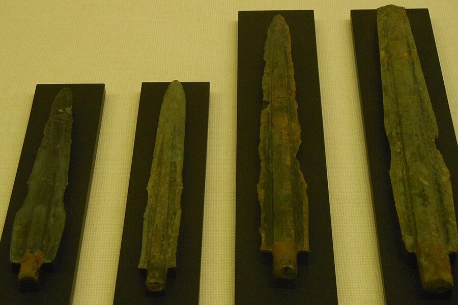
The first bronze daggers, halberds and spearheads were sharp and used, and a sword in a grave was a person’s own weapon. Over the following centuries the blades grew broader, thicker and longer, until spears and halberds were far too big to fight with and had become ritual objects, carried, displayed and buried.
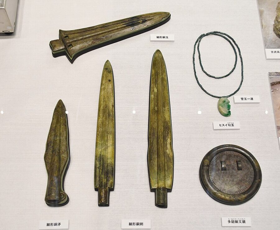
The richest early burials put together a set of objects I cannot look at without a jolt. At Yoshitake Takagi in western Fukuoka, burials of around the 2nd century BC sometimes called the oldest royal graves in Japan, one wooden coffin held two bronze swords, a bronze halberd, a spearhead, a multi-knobbed bronze mirror and a curved jade bead on a string of tube beads. A sword, a mirror and a jewel: the trio that the Kojiki of 712 and the Nihon shoki say the sun goddess Amaterasu handed down with her grandson, and that survive, unseen, as Japan’s three sacred treasures. The chronicles were written nine centuries after this grave was dug, and whatever they remember, the set was in the ground first.
Dōtaku: bells nobody remembered
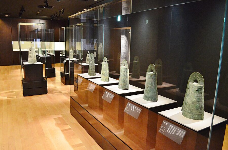
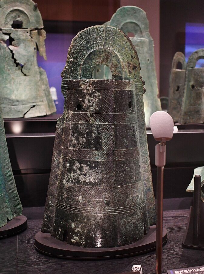
The Kinki region and its neighbours went their own way and made dōtaku (銅鐸): bell-shaped bronzes with an oval section, a loop on top and flanges down the sides. About five hundred are known. The earliest, 20 to 30 centimetres tall, were hung up and rung, with a clapper inside striking a raised band near the mouth; the largest, number 1 from Ōiwayama in Yasu on Lake Biwa, found in 1881, is 144 centimetres tall, weighs about 45 kilograms, and could not have been rung at all. The archaeologist Tanaka Migaku called this the shift from “bells for hearing” to “bells for looking at”.
The proof that the early ones were rung arrived only in 2015, when seven bells turned up on Awaji Island in a pile of sand dug from the coast at Matsuho. CT scans showed bronze clappers inside, with traces of the cords that had hung them, and analysis of the lead in their bronze matched material from the Korean peninsula.
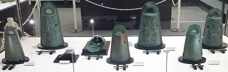
What is oddest about dōtaku is how completely they were forgotten. They were never put in graves but buried in shallow pits on hill slopes away from villages, and the custom of making them stopped abruptly in the 3rd century, just as the keyhole tombs appear. The Fusō ryakki records one dug up in 668 while a temple was being built in Ōmi, and the Shoku Nihongi notes one presented from Uda in Yamato in the sixth year of Wadō (713) as an object “of unusual form”. Neither the Kojiki nor the Nihon shoki mentions them at all.
The theories for the burials run from storage between festivals (the novelist Matsumoto Seichō liked that one) to offerings in a crisis, and none has won. The pictures cast on some bells, of deer, boars, herons, dragonflies, figures pounding grain with pestles and a granary on stilts, are the nearest thing the Yayoi left to a record of their own lives.
Kōjindani’s 358 swords
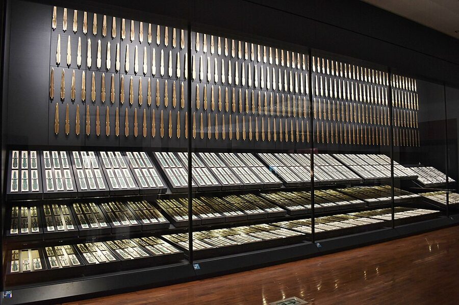
In 1983 Shimane Prefecture surveyed the route of a new farm road through Kanba, in what is now Izumo city, a place whose name means something like “the garden of the gods”. A surveyor picked up a sherd of Kofun-period stoneware on a valley slope, a trial trench went in, and in July 1984 the first bronze sword appeared. The diggers expected perhaps a hundred. There were 358, laid on a cut terrace in four tidy rows with their edges upright, all of one type, about 50 centimetres long and a little over 500 grams each.
That one find was more than all the Yayoi bronze swords found in Japan up to then. In 1985 a magnetometer survey led the team seven metres further up the valley, where six dōtaku lay with their loops facing each other beside sixteen bronze spearheads made in northern Kyushu. Three hundred and forty-four of the swords carry a cross scratched into the tang after casting, and nobody yet knows when the hoard was buried or why.
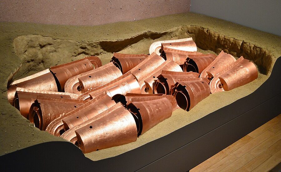
The cross turned up again twelve years later. On 14 October 1996 a bulldozer driver building another farm road at Kamo-Iwakura, about 3 kilometres away, hit something and stopped his machine, thinking someone had buried a plastic bucket. It was a dōtaku, and the pit held 39 of them, the largest single hoard in Japan, many nested small inside large, several scratched with the same cross as the Kōjindani swords.
Before 1984 Izumo’s ancient power was a matter of myth: the Kojiki gives the province a long cycle of its own gods and a famous handover of the land to Amaterasu’s line, and the Izumo fudoki of 733 lists 399 shrines in the province. After Kōjindani and Kamo-Iwakura it was a matter of archaeology. Whoever controlled that valley had more bronze than anyone else in the country, whatever the gods’ names were.
Iron, and who controlled it
Iron mattered more and survives worse. The islands did not smelt their own iron until the 6th century, so every Yayoi iron tool was made from material shipped across the Korea Strait, and the Wei zhi says plainly of the Byeonjin region of the southern peninsula that it produces iron and that the Han, the Ye and the Wa all come to take it.
The coast facing the Genkai Sea seems to have kept the trade in its own hands: late Yayoi sites there produce iron in quantity, while sites around the Inland Sea and in the Kinki region produce very little. At Ikegami-Sone near Osaka, one of the largest villages of its day, the excavators found some 1,300 finished stone reaping knives and very little iron. Many archaeologists suspect that control of the iron route was something later wars were fought over, a reasonable guess nobody has proved. By the 1st century BC the iron short sword had become the fighting blade of choice, and in the 1st century AD the first long, single-edged iron swords from the continent appear in the richest graves, remote ancestors of the Japanese sword.
The war that came with farming
The Jōmon were not saints. A handful of their skeletons carry arrow or axe wounds, and a Final Jōmon find at Itoku in Kōchi held ten people killed with blades, but the cases are so few that most archaeologists read them as feuds. With rice, the scale changed: organised violence between communities, with weapons designed for people.
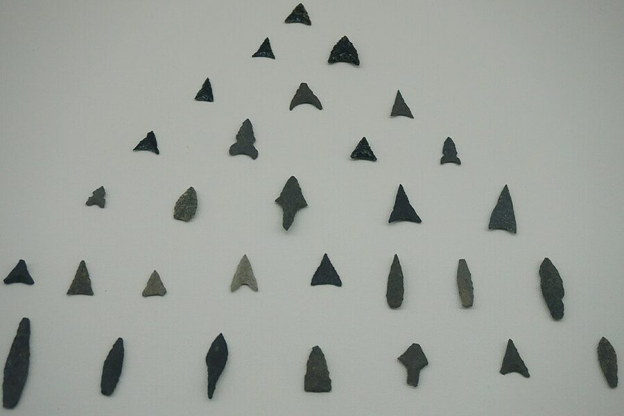
The earliest victim may be a man in wooden coffin number 24 among the Shinmachi dolmens, buried in the Initial Yayoi with a willow-leaf stone arrowhead lodged in his thigh bone. Under the coffin was a small pit holding another person’s teeth, and the excavators’ reading is that he was buried with the head of the man he had killed. Taking an enemy’s head was still the standard proof of a kill in the Sengoku era, and the custom among samurai has a very long pedigree indeed.
Stone and bronze points found inside jar coffins in northern Kyushu were long explained as a burial custom, a snapped-off weapon tip placed with the dead. Then, in 1975, a jar coffin at Sudare in Iizuka produced a man with the tip of a stone sword stuck in his vertebra, and the custom turned out to be wounds. At Doigahama, burial number 124, a well-built man wearing a bracelet of Gohōra shell from the southern islands, had fifteen stone arrowheads in his chest and abdomen and has been called “the hero” ever since.
The worst place is Aoya Kamijichi on the Tottori coast. In the ditch of a late Yayoi village, excavators recovered more than 5,300 human bone fragments from at least 109 people, at least ten of them with weapon wounds that never healed, among them a young woman of fifteen to eighteen killed by a blow to the forehead. Women, the elderly and small children were among the dead, and the waterlogged soil even preserved the brain tissue of three individuals.
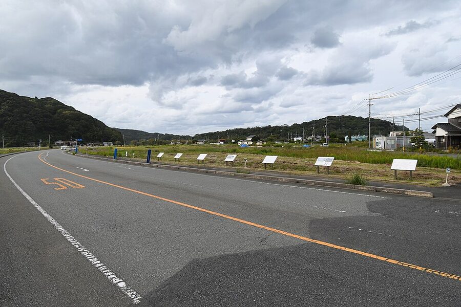
Moats, stakes and hilltops
The war shows in the ground as well as in the bones. Moated villages, kangō shūraku (環濠集落), appear in the Initial Yayoi at Etsuji in Kasuya and Naka in Hakata, then at Itazuke, and spread with rice as far as the Bōsō Peninsula and the Niigata coast. The ditches are V-shaped, with a bank thrown up from the spoil, often a palisade, and sometimes a belt of sharpened stakes set at an angle.
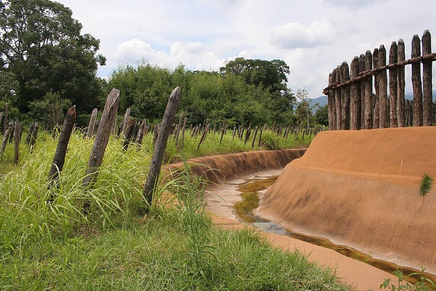
Not every moat was a defence, and you should keep an open mind at the reconstructions. Fujiwara Satoshi has pointed out that many western Japanese “moated villages” enclose nothing but storage pits, and that securely moated sites are a small minority of Yayoi settlements. Akatsuka Jirō argues that the famous stakes at Asahi, near Nagoya, were buried by flood sand after a short life and may have been flood defences all along.
Hilltop villages are the other sign. Twice, in the later Middle Yayoi and again late in the period, people around the Inland Sea built settlements on summits 50 to 300 metres above the plains; Shiudeyama in Kagawa sits at 352 metres. The later wave lines up with the disturbances the Chinese histories describe.
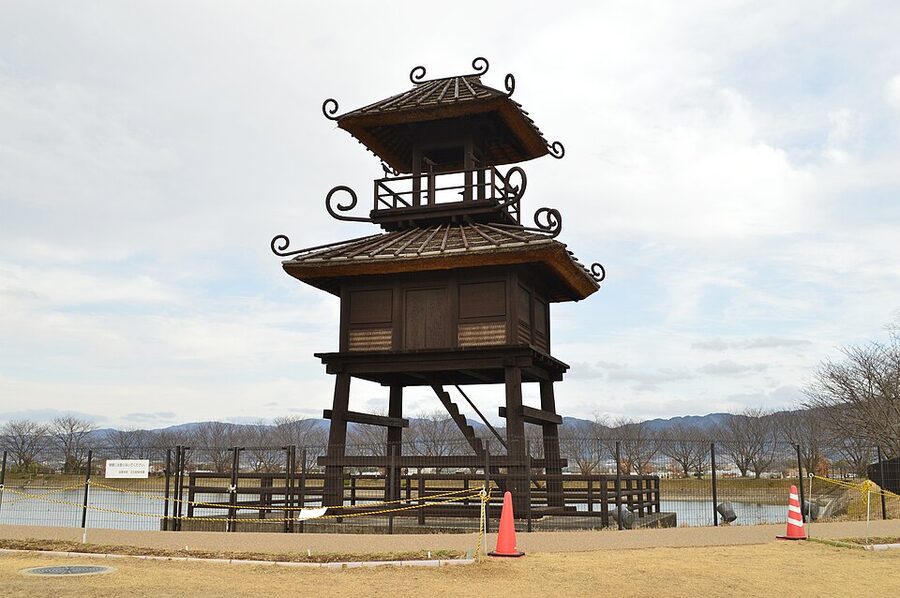
Big villages were also ceremonial centres. Karako-Kagi in Nara cast dōtaku, and a sherd from the site carries a drawing of a tall tower with spiralling roof ornaments, the source of the reconstruction by its pond. At Ikegami-Sone a great hall 17 metres by 7, with free-standing ridge posts at each end of the kind still used at Ise, stood over a well cut from a single camphor trunk; tree-ring dating of one of its cypress pillars says the tree was felled in 52 BC.
Yoshinogari
Yoshinogari is where the war has a face. Saga Prefecture began trial digs in 1983 on a low ridge earmarked for an industrial park, and the full excavation from 1986 showed a settlement over most of the ridge. On 23 February 1989 the national press broke the story, with the archaeologist Sahara Makoto among the loudest voices for keeping it, and the prefecture dropped the industrial park; the site became a Special Historic Site in 1991.
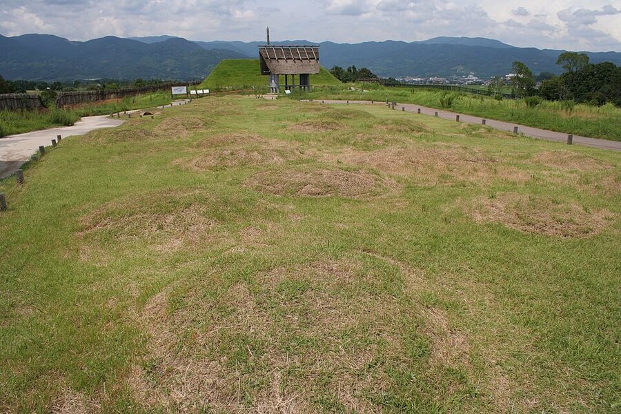
Scattered hamlets of the Early Yayoi became a single moated settlement in the Middle, and in the Late period an outer V-shaped moat some 2.5 kilometres around enclosed about 40 hectares, with two inner enclosures, watchtowers, palisades and stake barriers. The excavators estimated around 1,200 people living there at its height and some 5,400 in the polity it led. About 3,000 jar coffins were found on the ridge, and among their skeletons are people with arrowheads still in the bone and at least one body buried without its head.
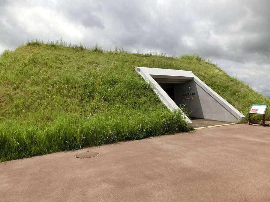
The burial mound at the north end, about 46 metres by 27 and once at least 4.5 metres high, was built for the elite in the 1st century BC. At least fourteen jar coffins were sunk into it from the top, with slender bronze daggers, one with its hilt ornament intact, and 79 glass tube beads.
When the moats and towers emerged, people seized on a line in the Wei zhi describing Himiko’s residence: palace halls, towers and stockades, strictly built and guarded. The archaeologist Mizuno Masayoshi pointed out the problems: the houses inside the inner enclosure were ordinary pit dwellings, the “tower” might as easily be a gate, and jar burials crowded right up to the inner moat, hardly the seclusion of a queen almost nobody saw. The dates fit poorly too, and one major primary-school history textbook of 2024 presents Yoshinogari as a typical moated village rather than as a candidate for Himiko’s capital.
The question did not quite die. Hiyoshi Shrine, which had sat on an unexcavated patch in the middle of the site, was moved in 2022, and in April 2023 the diggers found a stone coffin there of the late 2nd to mid 3rd century, its lid scratched with lines. It was opened in front of the press that June: red pigment, no bones and no grave goods, which in its way was the most Yayoi result possible.
A gold seal from the emperor of Han
Chinese historians knew the Wa long before the Wa wrote anything down. The Han shu, compiled in the 1st century AD, says that beyond the Lelang commandery in Korea, in the sea, live the Wa, divided into more than a hundred countries, who come with tribute at the proper seasons. The Hou Han shu (Book of the Later Han), which Fan Ye put together in the 5th century, gives the first dated contact: in AD 57 the country of Na sent an envoy calling himself a high official, from the southernmost edge of the Wa lands, and the emperor Guangwu gave him a seal and ribbon.
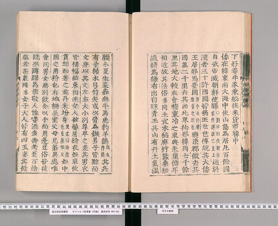
The same book records that in 107 a Wa king called Suishō presented 160 seikō, captives or slaves, to the Han court. Fan Ye was writing more than three centuries after the events, from archives, and treats the Wa as a minor frontier people. These are the earliest written sources on Japan, but they are written from very far away.
Found under a stone on Shikanoshima
The seal came out of the ground on Shikanoshima, the island at the tip of the sandspit that closes Hakata Bay, on the 23rd day of the second month of Tenmei 4 (1784) by the old calendar. The usual story names a farmer called Jinbei who lifted a large stone in his field and found a small gold object in a box of three smaller stones; another reading of the documents makes Jinbei the employer of the two men who found it. English-language accounts usually give “23 February 1784”, which is the lunar date written as if it were Western; some Japanese sources convert it to 12 April 1784 by the Western calendar.
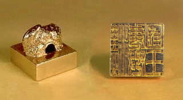
The seal went to the Kuroda lords of the Fukuoka domain, and the Confucian scholar Kamei Nanmei, newly put in charge of one of the domain’s two schools, identified it from the Hou Han shu and wrote a treatise on it. The Kuroda family kept it through the Edo era and beyond, gave it to the city of Fukuoka in 1978, and it has been on permanent display at the Fukuoka City Museum since 1990.
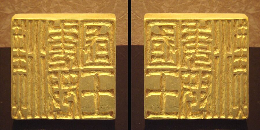
The object is tiny. The face averages 2.347 centimetres a side, almost exactly one Later Han cun, and the seal weighs 108.7 grams and is about 95 percent gold. The knob is a coiled snake looking back over its shoulder, and the five characters, cut in three columns, read 漢委奴國王, conventionally Kan no Wa no Na no kokuō, “King of Na of the Wa, of Han”, the reading Miyake Yonekichi proposed in 1892. A minority reads the middle characters as Ito, the neighbouring country on the Itoshima plain.
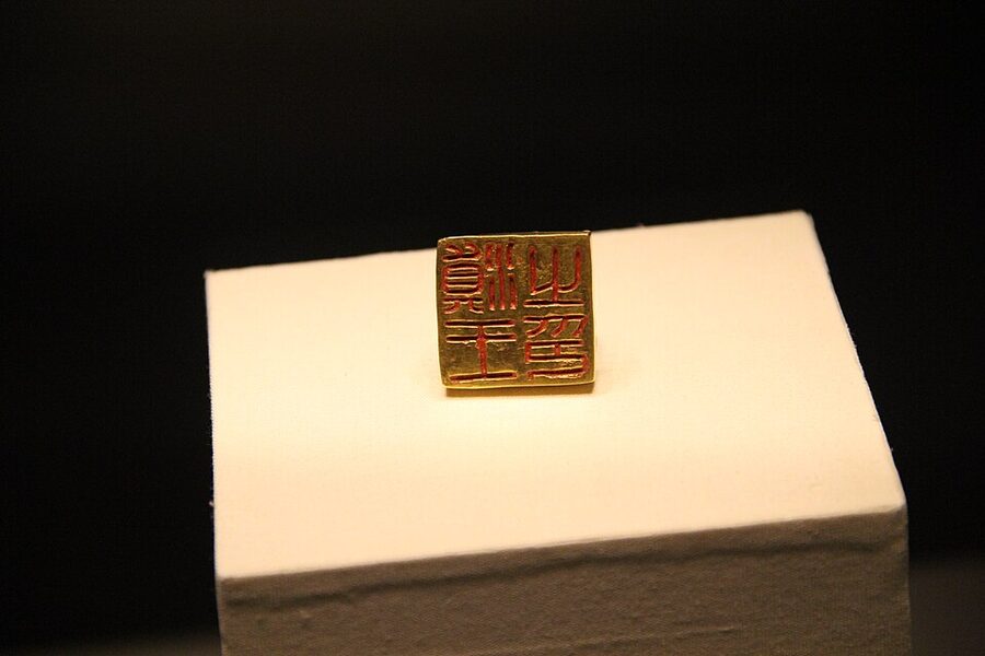
Snake knobs seem to have gone to peoples the Han placed in the south; the Han evidently thought the Wa lay somewhere off southern China. The best parallel is the gold seal of the King of Dian in Yunnan, which matches a grant recorded for 109 BC and was excavated in 1956, and the historian Nishijima Sadao showed that the two belong to the same system of investiture.
Doubts about the seal go back to 1836 and have never quite gone away; the literary scholar Miura Sukeyuki argued in a 2006 book that Kamei Nanmei forged it to make his school’s name. The case against is technical and, I think, stronger: the exact length of a Han cun was not established until the 20th century, and the Edo-period seal catalogues a forger could have used show no snake knobs and write Wa with the full 倭. Most specialists accept the seal as genuine.
The island has other memories. Shikanoshima was one of the places where Japanese defenders fought the Yuan fleet hand to hand in the summer of 1281, during the second of the Mongol invasions.
A hundred countries and a queen
The Wei zhi, the account of the Wa in Chen Shou’s Records of the Three Kingdoms, compiled in the 280s or 290s, says the Wa “formerly” had more than a hundred countries and that thirty were now in contact with Wei. It walks the reader from the Korean coast across Tsushima and Iki to Matsuro on the Karatsu coast, where Nabatake lies, then to Ito, where Wei envoys always stopped, and to Na, with more than twenty thousand households and officials called Shimako and Hinamori.
The archaeology fits the text strikingly well. In 1899 a man at Sugu-Okamoto in Kasuga moved a large stone and found a jar coffin under it with around thirty Former Han mirrors, and the Sugu sites, with their bronze foundries and royal burials, are generally accepted as the heart of Na. Mikumo-Minamishōji in Itoshima, Ito’s royal cemetery, yielded more than fifty Chinese mirrors from two jar coffins, and a late burial at Hirabaru nearby produced five bronze mirrors 46.5 centimetres across.
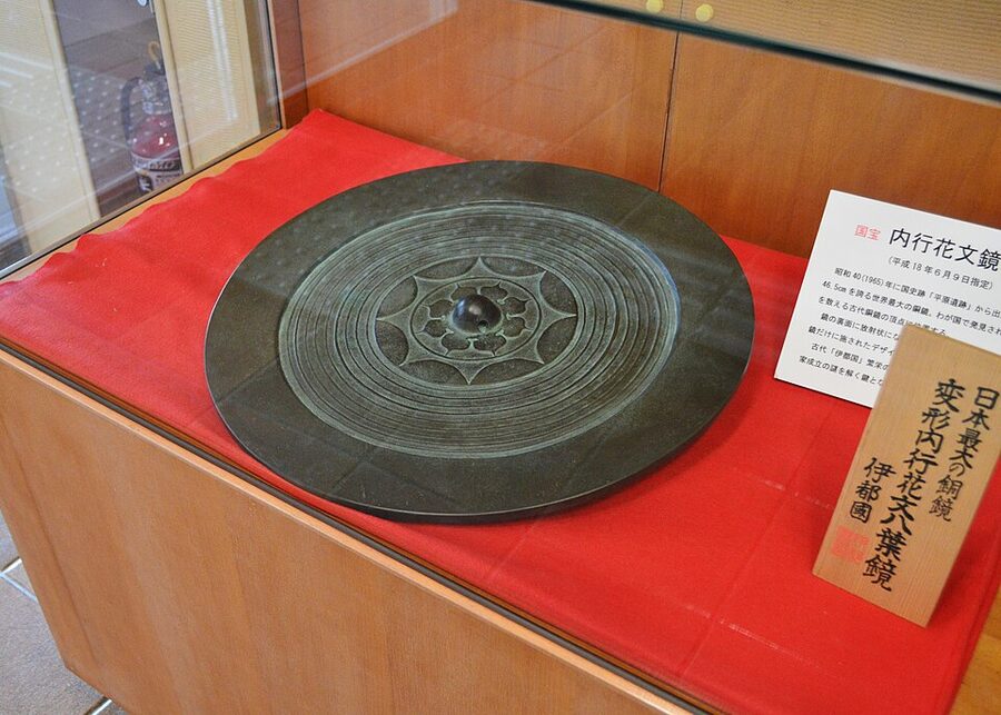
The Wei zhi is also the only written description of how Yayoi people lived. The men tattoo their faces and bodies, originally to scare off large fish when diving; they eat with their fingers from pedestalled dishes; the land has no oxen or horses; they clap their hands in worship, as you still do at a shrine such as Fushimi Inari. Much of it the excavators keep confirming.
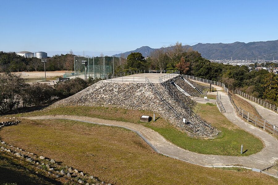
Across western Japan, chiefs were building themselves mounds. The Tatetsuki mound at Kurashiki in Okayama, of the late 2nd century, is about 80 metres long, and its funerals used tall decorated pottery stands, tokushu kidai, the ancestors of the cylinders set round early Kofun tombs. In Izumo and along the Sea of Japan coast chiefs built square mounds with four projecting corners and stone-faced slopes.
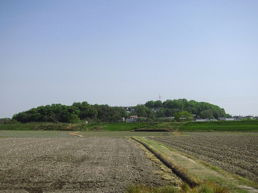
When the keyhole tomb appears, it borrows from all of them: Kibi’s pottery stands, Izumo’s stone facing, northern Kyushu’s appetite for Chinese mirrors. The archaeologist Tsude Hiroshi saw the result as a “keyhole tomb system”, in which a common tomb shape signalled membership of a single alliance. The moated villages went out of use at the same time; at Yoshinogari the moats were filled with discarded pottery and the hill became a cemetery.
Before that alliance came a war. The Hou Han shu says the Wa were in great disorder in the reigns of the emperors Huan and Ling, between 146 and 189, attacking one another for years without a ruler, and the later Liang shu narrows it to 178 to 184. All the accounts end the same way: the countries jointly set up an unmarried woman who served the spirits and bewitched the people. Her name was Himiko, and her reign, her embassies to Wei and the argument over where her capital stood are told in her own article.
Within a generation of Himiko’s death the first giant keyhole tomb rose at Makimuku in the Nara basin. Rekihaku’s radiocarbon work on Hashihaka, published in 2009, dated it to between 240 and 260, close to the year around 248 in which the Wei zhi places her death; critics, many of them partisans of a Kyushu Yamatai, prefer the later 3rd or early 4th century. Either way the Yayoi period ends at Hashihaka, and the rest of the story runs through Japan through the ages.
The chronicles of 712 and 720 remember none of this as history, but they remember rice. In one variant tradition in the Nihon shoki, Amaterasu gives her grandson ears of rice from the sacred fields of heaven, and the old poetic name for the country is the land of luxuriant reed plains and fresh rice ears. Rice became the business of the gods, from the harvest rites at Ise to the foxes of the rice deity Inari, whose story is told in the article on kitsune.
Where to see the Yayoi period today
The sites are scattered from Saga to Tokyo. If you have one day, make it Yoshinogari; if you have two in northern Kyushu, add Fukuoka for the gold seal. Toro is an easy stop on the Tōkaidō, and the Izumo bronzes reward a trip to the Sea of Japan coast.
Yoshinogari Historical Park, Saga
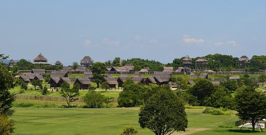
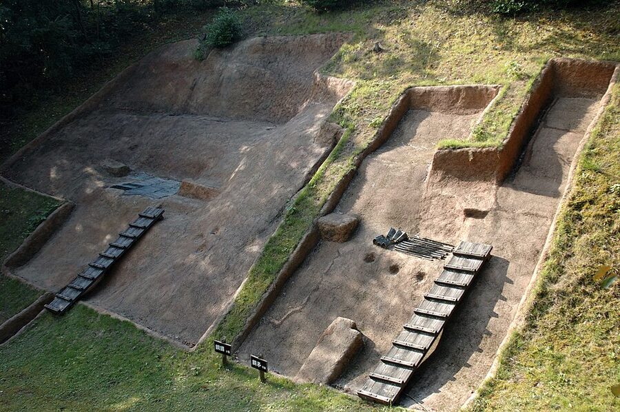
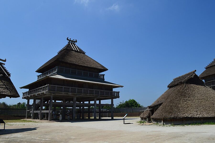
Yoshinogari is the biggest Yayoi reconstruction in Japan, and the most theatrical. The park covers about 117 hectares and puts the moats, palisades, stake barriers, watchtowers, granaries, pit dwellings and the northern inner enclosure back on the ground, mostly over their own excavated footprints, which lie protected under a layer of fill. Treat the upper storeys of the buildings as educated guesses, because they are.
The part I find most convincing is the simplest: walking the line of the outer moat and seeing how much ground it encloses. The site is also, slightly absurdly, number 88 on the list of Japan’s 100 Fine Castles, in the same company as Himeji.
Do not skip the northern burial mound, where an exhibition hall built inside shows the excavated section of the mound and the jar coffins as they were found. The bronze daggers and glass beads from those coffins belong to the Agency for Cultural Affairs and are usually shown at the Saga Prefectural Museum in Saga city instead.
The park opens from 9:00 to 17:00, to 18:00 from June to August, and is closed on 31 December and on the third Monday of January and the day after. Admission is ¥460 for adults, ¥200 for those 65 and over, and free for junior high school students and younger. The East Gate, the main entrance for the archaeology, is about fifteen minutes’ walk from Yoshinogari-kōen Station on the JR Nagasaki Line, which you reach from Hakata by changing at Shin-Tosu or Tosu; Kanzaki Station, one stop on, leads to the West Gate, the wrong end.
The gold seal: Fukuoka City Museum and Shikanoshima
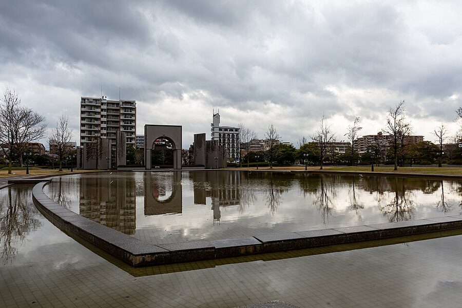
The seal sits in the permanent galleries of the Fukuoka City Museum in Momochi, and you will be surprised how small it is. When it is lent out a replica takes its place, so check the museum’s website before you make a special trip. The museum opens from 9:30 to 17:30 (last entry 17:00), and closes on Mondays, or the next weekday when Monday is a public holiday, and from 28 December to 4 January.
The permanent galleries cost ¥200 for adults and ¥150 for high school and university students, and are free for junior high school age and under. The nearest subway stop is Nishijin on the Kūkō Line, about fifteen minutes’ walk from Exit 1.
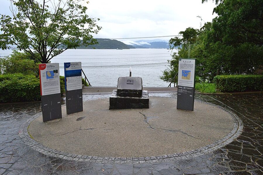
Kin’in Park on Shikanoshima marks the traditional findspot with a monument and information boards looking out over Hakata Bay. There is not much to it, but the view across the water to the city is fine and the island makes a good half-day out. The Fukuoka city ferry from Hakata Port takes about half an hour, and the Kin’inzuka stop on the Nishitetsu bus is about two minutes’ walk from the park.
Itazuke and Nabatake
Itazuke, in Hakata Ward and a Nishitetsu bus ride from Hakata Station, has its reconstructed moat, pit dwellings and a small paddy in a park among housing estates, with the finds in the small Itazuke Yayoi-kan, open 9:00 to 17:00 (entry until 16:30) except over the New Year. Nabatake, about a kilometre west of JR Karatsu Station, has its paddy and the small Matsuro-kan museum, named after the Wei zhi‘s country of Matsuro. Both are quiet, specialist stops.
Toro, Shizuoka
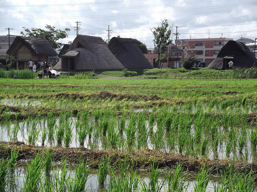
Toro was found in 1943 during construction of a munitions factory, and its excavation from 1947, the first in Japan to bring archaeologists, anthropologists and geologists together, became a national project in the hungry years after the war; for a generation of Japanese schoolchildren Toro simply was the Yayoi period. Its twelve houses and two granaries stood on a levee of the Abe River with more than 80,000 square metres of paddies to the south, and the waterlogged ground preserved wooden hoes, spades, paddy clogs, a fire drill and a lacquered koto. The houses are not true pit dwellings: the water table was too high to dig down, so the builders raised earth banks around a floor at ground level.
The site park, the museum’s ground floor and its roof terrace are free. The Shizuoka City Toro Museum’s paid galleries open from 9:00 to 16:30 and cost ¥300 for adults, ¥200 for high school and university students and ¥50 for elementary and junior high school students; they are closed on Mondays (the next day if Monday is a holiday), the day after a public holiday and over the New Year. Take the Shizutetsu Justline bus from stand 22 at the south exit of JR Shizuoka Station to the Toro Iseki terminus, about ten minutes.
The Izumo bronzes: Shimane Museum of Ancient Izumo
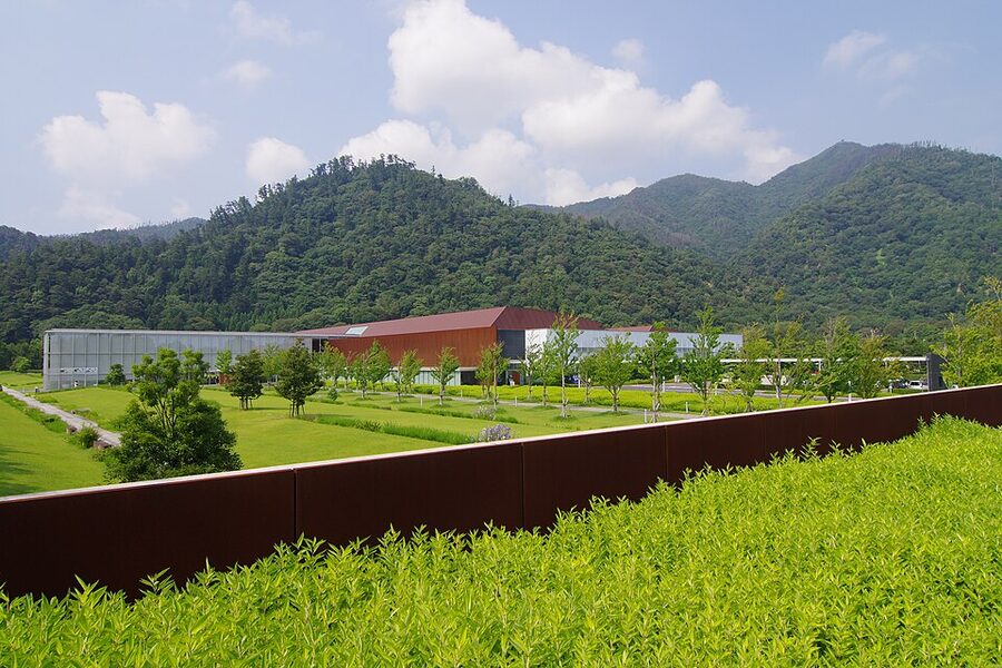
The Kōjindani swords, spearheads and bells and the 39 bells of Kamo-Iwakura are National Treasures, and the Shimane Museum of Ancient Izumo, next door to Izumo Taisha, shows them together. Seeing the swords in their massed ranks does more for your sense of the Yayoi economy than any number of single objects in cases. The museum opens from 9:00 to 18:00, or to 17:00 from November to February, and closes on the first and third Tuesdays of the month; since April 2026 admission has been ¥680, ¥450 for university students and ¥220 for school students. It is a seven-minute walk from Izumo-taisha-mae Station on the Ichibata Electric Railway.
Yayoi-chō, Tokyo: where the name came from
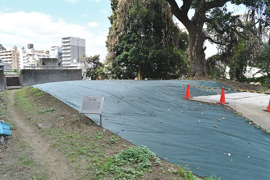
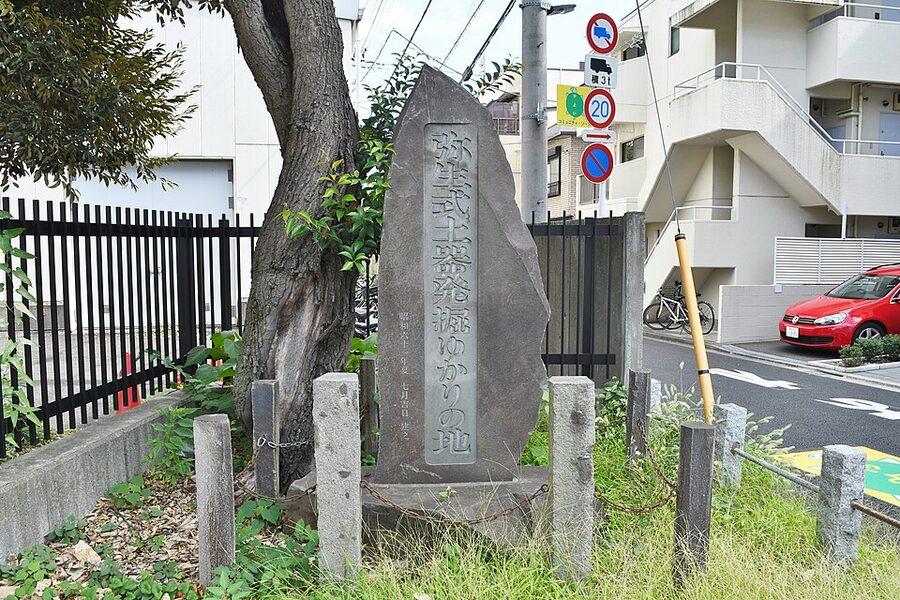
The memorial stone to the discovery of Yayoi pottery stands at Yayoi 2-11 in Bunkyō, between the University of Tokyo’s faculties of agriculture and engineering, about three minutes’ walk from Nezu Station on the Chiyoda Line or five from Tōdaimae on the Namboku Line. The excavated ditch of the Yayoi 2-chōme site is inside the Asano campus nearby, and when it is not under tarpaulins there is little to see but a sign. It is a pilgrimage for the pedantic, and I say that with affection.
A replica of the 1884 jar is in the ground-floor gallery of the Bunkyō Furusato Historical Museum in Hongō, five minutes from Hongō-sanchōme Station; it opens from 10:00 to 17:00, closes on Mondays and the fourth Tuesday of each month, and charges ¥100. Ueno, where the archaeology gallery in the Tokyo National Museum’s Heiseikan has a good run of Yayoi pottery and bells, is about twenty minutes’ walk away.
Go in the third month of the old calendar if you can, which falls roughly in April, when the cherry trees of Ueno are in flower and the word on Nariaki’s stone makes sense; the article on sakura will help you plan it. Stand at the marker, look down the slope towards Nezu, and remember that somewhere under these houses, nobody knows exactly where, a student picked up a broken jar and gave a name to the age when Japan learned to farm. The archaeologists have been arguing over both ever since.