In the autumn of 1252 the shogunate banned the sale of sake in Kamakura and sent its officials from house to house to count the jars. They found 37,274 of them. Each household was allowed to keep one, and every other jar in town was broken, which must have made for a long, wet and bad-tempered day in the merchant streets behind the beach.
Nobody ever took a census of medieval Kamakura, so that tally, entered in the shogunate’s own chronicle, the Azuma kagami (吾妻鏡), is about the best number anyone has. The historian Ishii Susumu reckoned it meant something like ten thousand households. Seventy-two years earlier, by the same chronicle’s account, the place had been a backwater of fishermen and old farmers. Eighty-one years later it would be on fire.
That was Kamakura at its height. The same year the first imperial prince to serve as shogun rode in round the point at Inamuragasaki, and in the eighth month the casting began on a bronze Buddha in the Hase valley.
The regime that ran Japan from here has its own piece, the Kamakura era, as do its founder, Minamoto no Yoritomo, and the Zen monasteries of the northern valleys, in my history of Zen Buddhism. This piece is about the town: a valley walled by hills and open to the sea, a straight road, a shrine, a Buddha that lost its building, the bones in the sand, and what happened after the shoguns left. At the end I’ll tell you how to see it in a day or two.
In This Article
- A backwater with good connections
- Seven ways in, and one road to the sea
- The shrine at the top of the street
- A Buddha without a building
- Monks from Song China
- The tide at Inamuragasaki
- Shoguns of the east, and a town gone to seed
- Sea air, a railway and the Kamakura writers
- The bid that ICOMOS turned down
- Where to see Kamakura today
- Getting around: the Enoden
- Day one: Kita-Kamakura, the shrine and the Buddha
- Kōtoku-in and Hase-dera
- Day two: the eastern valleys
- The Daibutsu trail and Zeniarai Benten
- Seasons, flowers and festivals
- One jar per household
A backwater with good connections
The Azuma kagami tells the founding as a miracle of improvement. When Yoritomo moved into his new residence in the twelfth month of 1180, it says, the place had always been remote, with hardly anyone living there but fishermen and old peasants; from that moment the roads were straightened, the villages given names, and houses and gates rose roof to roof. It is a good story, and it is meant to be. Japanese historians now read the passage, written under the Hōjō regents a century later, as flattery for a founder, a tale of a warrior government rising out of nothing that would be recycled for Tokugawa Ieyasu riding into a supposedly empty Edo.
Kamakura was nothing of the sort. In the 8th century it was the seat of a district government, and archaeologists digging under the Onari primary school beside the station have found the posts of large official buildings and a wooden tax tag dated 733. The Man’yōshū, the great 8th-century poetry anthology, already names its hills.
The name has two folk explanations. One says the courtier Fujiwara no Kamatari buried his sickle (kama) here after a dream, a legend apparently invented after 1226, when a Fujiwara child became shogun. The other, which I prefer, says the horseshoe of hills looks like the back of a kamado, a cooking stove. Stand on the beach and look inland, and it does.
What made Kamakura Yoritomo’s was family. In the 11th century Taira no Naokata gave his house here, with his daughter, to a rising Minamoto general, Minamoto no Yoriyoshi, who in 1063 set up a shrine to Hachiman, his clan’s god of war, near the beach at Yui; Yoritomo’s own father kept a house in the Kamegayatsu valley, where Jufuku-ji now stands. So when Yoritomo came here in the tenth month of 1180, beaten at Ishibashiyama, regrouped across the bay in Awa, and gathering the eastern warrior houses for the Genpei War, he was not discovering a fishing village. He was going home to a place his ancestors had chosen first.
The hills did the rest, or so the textbooks say. In 1183 the Kyoto courtier Kujō Kanezane wrote of “Kamakura castle” in his diary, and in 1959 the archaeologist Akahoshi Naotada built on the phrase a famous theory: the whole valley was a fortress, its ridges cut into sheer artificial cliffs. Excavation has been unkind to it. The best known of those cliffs, the great scarp at Osarubatake above Nagoe, turned out to be a quarry, and the historian Saitō Shin’ichi argues that Kanezane’s “castle” simply meant Yoritomo’s base.
My own view is that the hills were a defence in the way a hedge is a defence. They funnelled traffic through a few gaps where you could put a gate, and they were no use at all against the sea, which is how the town would eventually fall.
Seven ways in, and one road to the sea
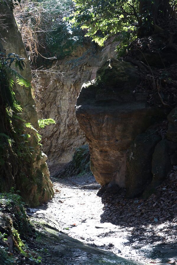
Every guidebook will tell you that Kamakura had seven entrances, the Kamakura nanakuchi (鎌倉七口), cuttings called kiridōshi that sliced through the ridges: Gokurakuji-zaka, the Daibutsu pass, Kewaizaka, Kamegayatsu-zaka, Kobukurozaka, Asaina and Nagoe. The number is an Edo invention, first listed in the 1640s on the model of Kyoto’s “seven entrances” and fixed by the Shinpen Kamakura-shi, the guidebook that the lord of Mito, Tokugawa Mitsukuni, had his scholars publish in 1685. Medieval records mention routes the list leaves out, and the Daibutsu pass does not appear in any Kamakura-period source at all.
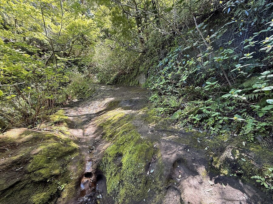
The cuttings are real enough, though, and some are documented. The Azuma kagami records work on the Asaina pass, the eastern road over to the port of Mutsura on Tokyo Bay, in 1241 and 1242 under the regent Hōjō Yasutoki, and says that when the job fell behind he carried earth and stones himself. The legend that the strongman Asahina Yoshihide hacked the whole thing out in one night, which gave the pass its name, is first heard of in the Edo period. Nagoe, the southern way out towards the Miura peninsula, is named in the same chronicle under the 18th day of the eighth month of 1233.
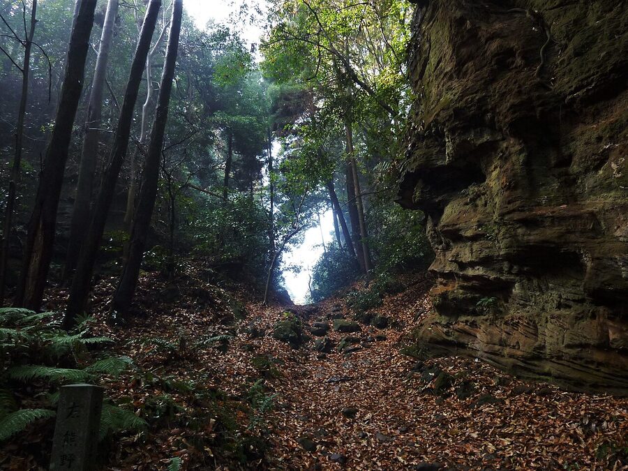
Do not imagine you are walking on Yasutoki’s road surface: when Zushi excavated the Nagoe pass, the lowest road level it reached held pottery of the late 18th century. Kewaizaka gives you the best idea of what the cuttings did. At the end of the 13th century the court lady Nijō, author of one of the great memoirs of the age, stood at the top of it and wrote that looking down on Kamakura was nothing like looking at Kyoto from the eastern hills: the houses were stacked up the valleys like steps, as if someone had stuffed people into a bag.
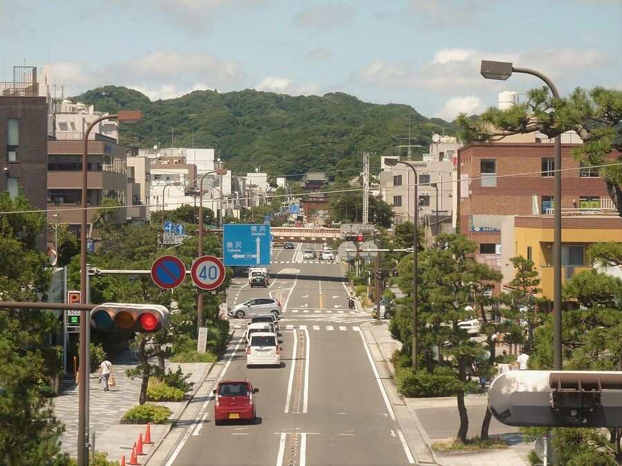
Inside the hills the plan was simple. In the third month of 1182, with his wife Hōjō Masako pregnant with their first son, Yoritomo had a straight avenue built from the shrine down to the beach at Yui as a prayer for a safe birth, and the Azuma kagami says he supervised it himself while his vassals carried the stones. This is Wakamiya-ōji (若宮大路), Kamakura’s answer to the Suzaku avenue of Kyoto, and excavation has shown that its upper half was about 33 metres wide, an enormous road for a town of wooden houses. The boy, Yoriie, was born in the eighth month, which in Kamakura counted as proof that it worked.
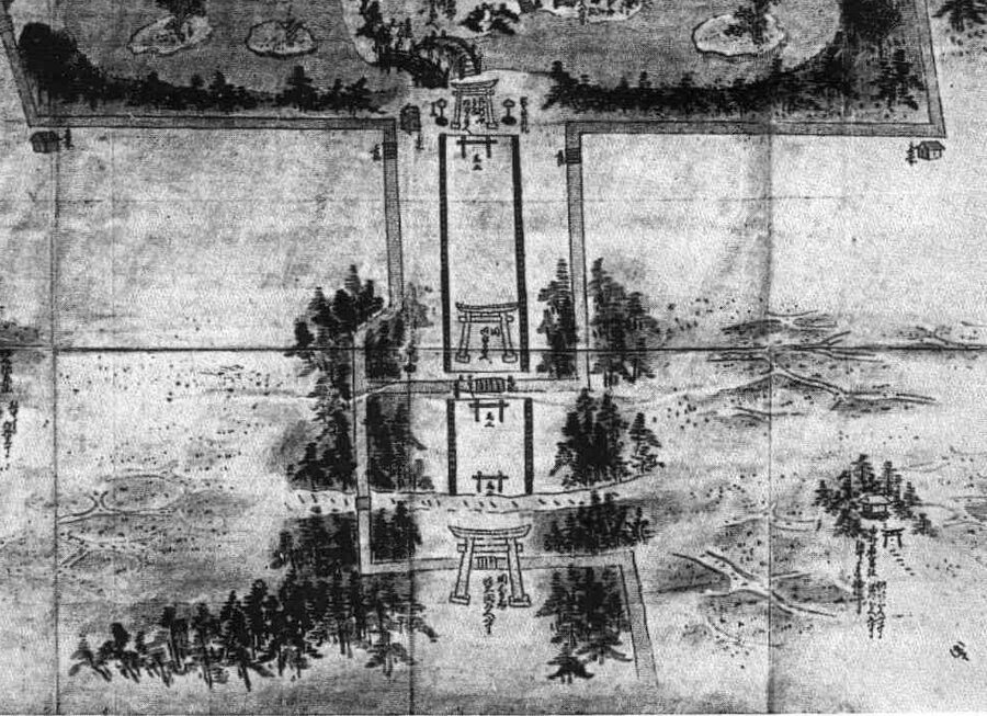
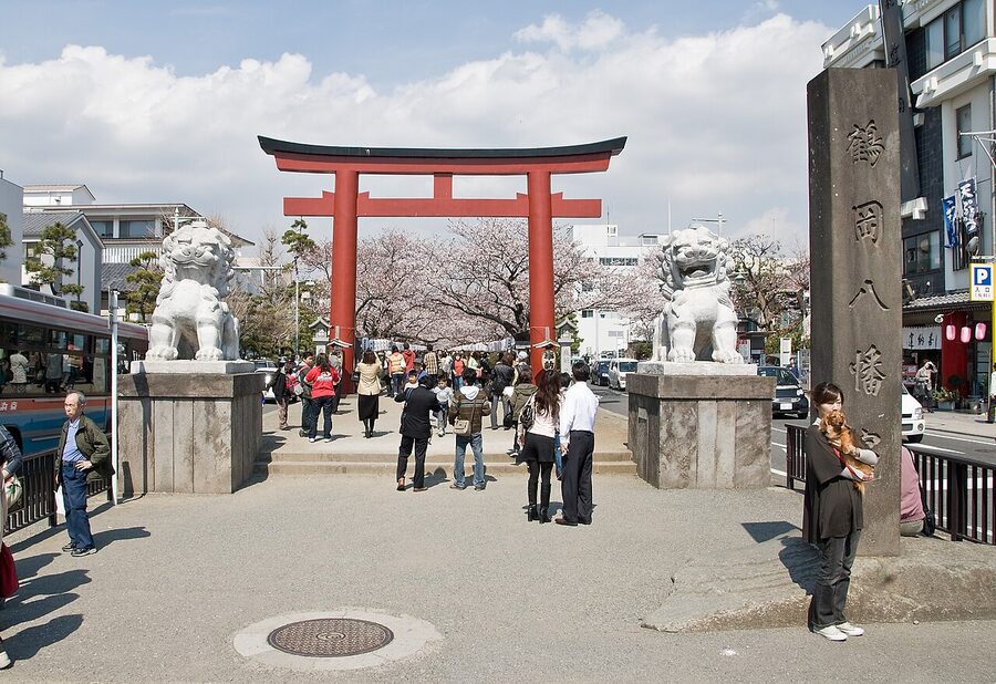
Down the middle runs the dankazura (段葛), a raised walk between stone kerbs that once ran 1.3 kilometres to the first torii. The usual explanation is drainage: every rain sent mud off the new hillside house plots onto the road, and a raised walk kept the shrine’s processions out of the puddles. Sewer works in front of the shrine found the medieval paving about 1.8 metres under the modern road, and the walk you stroll on now was rebuilt over the centuries, perhaps mostly in the 16th. Its last 480 metres survive between the second and third torii; earthquakes and the 1889 railway took the rest.
The money came in by sea. In 1223 a traveller arriving from Kyoto, the anonymous author of the Kaidōki, counted hundreds of boats moored along the shore. Big ships could not get close to the shallow beach, so in the seventh month of 1232 a monk called Ōamidabutsu, an engineer who had built a harbour in Kyushu, asked permission to make one here, and Yasutoki backed him. Wakaejima (和賀江島), a breakwater of boulders off the eastern end of the beach, was finished in under a month, and it is the oldest harbour work still standing in Japan.
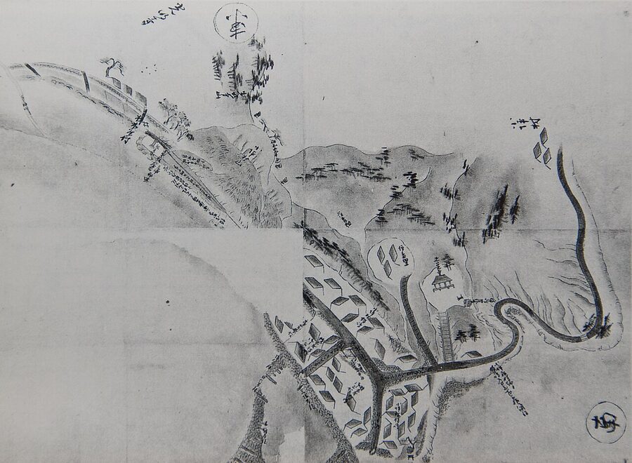
The ships came from Kyushu, the far north and China; in 1254 the shogunate tried to limit Chinese vessels to five, which tells you there were more. The eastern end of the bay is still called Zaimokuza, after the guild of timber merchants who landed the wood for the temples. The markets lay down by the shore and the warrior houses and great temples up in the valleys, roughly where they still are.
The shrine at the top of the street
Yoriyoshi’s Hachiman shrine of 1063 stood near the beach in what is now Zaimokuza, and a small shrine called Moto Hachiman, the “original Hachiman”, still marks the spot among the houses. On the 12th day of the tenth month of 1180, days after he arrived, Yoritomo had it moved to the foot of the northern hill, and he built his own residence at Ōkura just to the east. Everything else was laid out from there. A study prepared for the World Heritage bid made the point that a Chinese-style capital puts the palace at the head of its main avenue; Kamakura put a shrine.
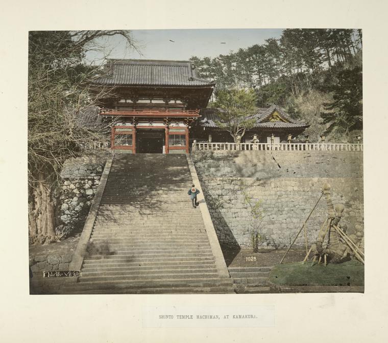
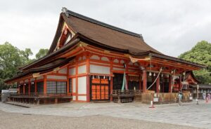
The shrine you visit is Tsurugaoka Hachimangū (鶴岡八幡宮). After a fire in 1191 it was rebuilt as an upper shrine on the hill and a lower one below, and the two ponds at the entrance were dug in 1182. Guides will tell you that the Genji pond has three islands because san, three, sounds like birth, and the Heike pond has four because shi, four, sounds like death, a pun the Taira would not have enjoyed. The bridge between them was red in the Middle Ages, and a branch of the Hōjō took its name, Akahashi, from it; remember them, because the last of the Akahashi regents will die fighting just outside the town in 1333.
The Taira had their sea shrine at Itsukushima; the Minamoto had this one, and did their most famous public business here, much of it ugly.
In the third month of 1186 Shizuka Gozen, the dancer who had been the lover of Yoritomo’s brother Minamoto no Yoshitsune, now a fugitive, was brought to Kamakura under guard. On the 8th day of the fourth month Yoritomo and Masako ordered her to dance for the god at the shrine, and she sang two poems longing for Yoshitsune instead: one of them about following his footprints through the snow on Mount Yoshino. Yoritomo was furious, and Masako talked him down, saying she would have sung the same in Shizuka’s place.
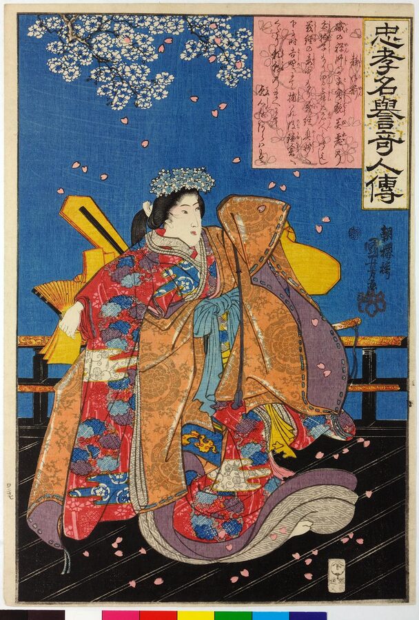
The sequel is worse. Shizuka was pregnant, and Yoritomo ordered that if the child was a boy it must die; in the intercalary seventh month she gave birth to a son, and he was taken from her and left on the beach at Yui. The only source for any of this is the Azuma kagami, and Japanese historians point out that the Hōjō chronicle has every reason to make Yoritomo cruel and his Hōjō wife merciful. Her story belongs with the other women in my piece on samurai women, where the chroniclers’ motives come up again and again.
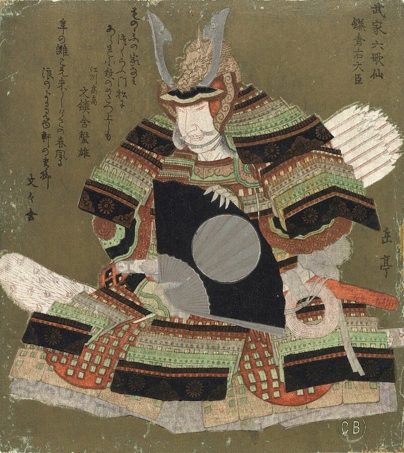
Thirty-three years later the shrine got its murder. Yoritomo’s second son, Sanetomo, became shogun at eleven and grew into the best poet the warrior class ever produced; asked who the finest poet of the middle ages was, Bashō is said to have answered “Saigyō and the Minister of the Right of Kamakura”. He was not much of a soldier. In 1217 he had a Chinese engineer build him a ship to sail to the Chinese mountain where he believed he had lived a former life, and when it was hauled down the beach at Yui it would not float.
On the 27th day of the first month of 1219, with snow two feet deep, Sanetomo came to the shrine at night to give thanks for his appointment as Minister of the Right. As he came down the stone steps after the rites, his nephew Kugyō, the son of his murdered elder brother, not yet twenty and the shrine’s own chief priest, stepped on the trailing hem of his robe, knocked him down and cut off his head, shouting, according to the Azuma kagami, “This is how a father’s enemy is killed.” Kugyō’s companions cut down Minamoto no Nakaakira, apparently mistaking him for the regent Hōjō Yoshitoki, who had felt unwell and gone home earlier, a piece of luck historians have been eyeing suspiciously ever since. The monk Jien, writing in Kyoto a year or two later, says there was no shout and that the thousands of warriors waiting outside the torii did not even notice until the courtiers came running.
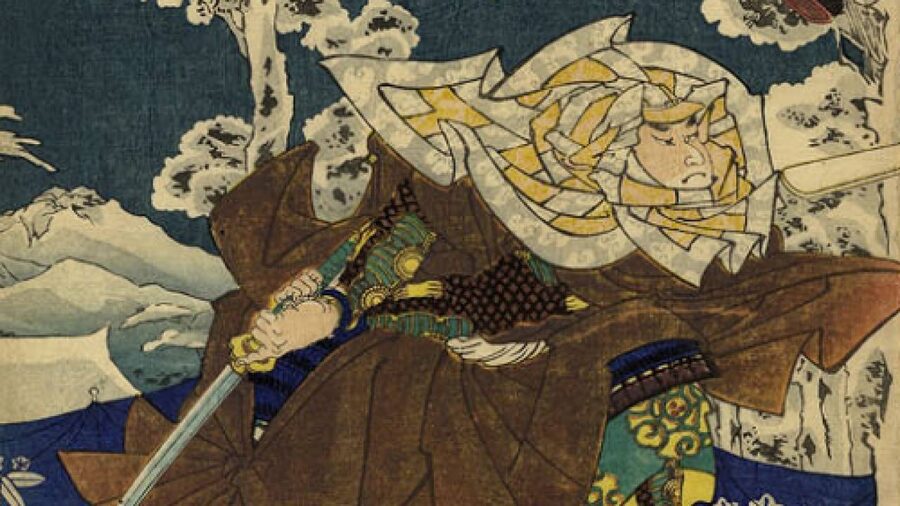
Kugyō was hunted down and killed the same day by men sent by his own guardian, Miura Yoshimura. The Azuma kagami says Sanetomo’s head was never found and a lock of his hair was buried instead; Jien says it turned up in the snow on the hill; a mound at Hadano, well to the west, claims one of his warriors carried it there. With him the line of Yoritomo was finished, and the Hōjō regents ran the country through puppet shoguns for the next 114 years.
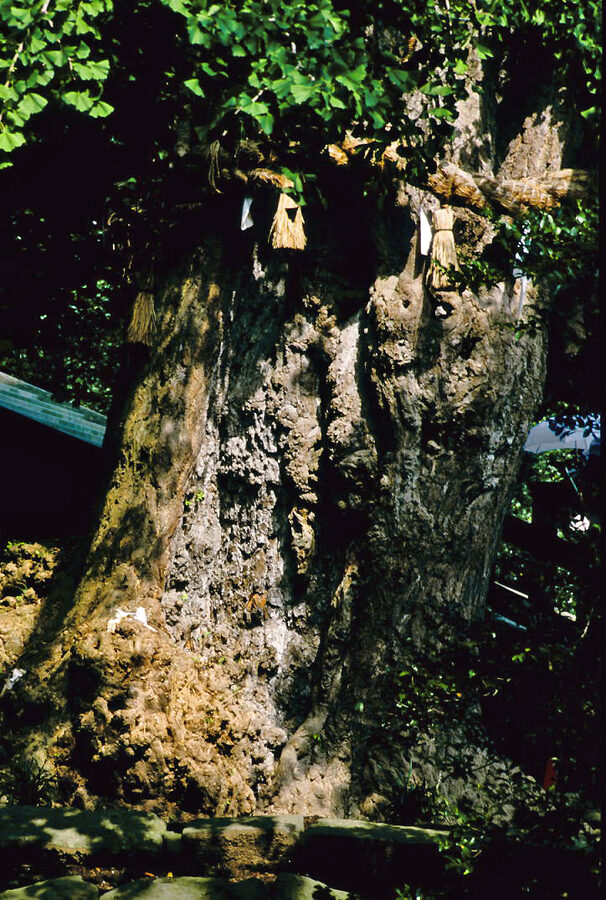
You will be told that Kugyō hid behind the great ginkgo beside the steps, and that the tree you see is the very one, a thousand years old. Neither the Azuma kagami nor Jien mentions a tree; the story first appears in the Edo period, and some botanists doubt that any ginkgo in Japan in 1219 could have been big enough to hide a man. At about 4:40 in the morning of 10 March 2010, in a strong wind, the ginkgo came down at the roots; an expert who examined it blamed rot. The shrine cut it into three, replanted the bottom four metres of trunk seven metres away five days later, and within a month it was putting out shoots.
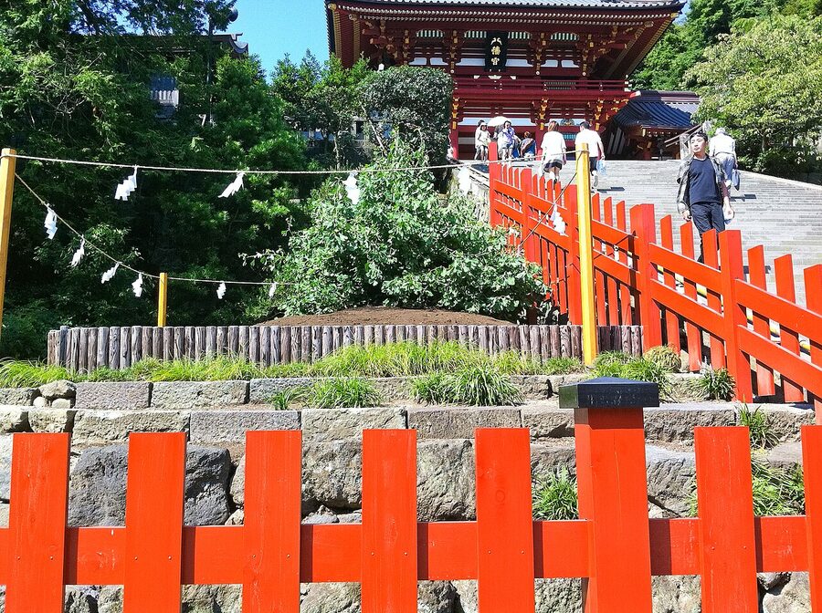
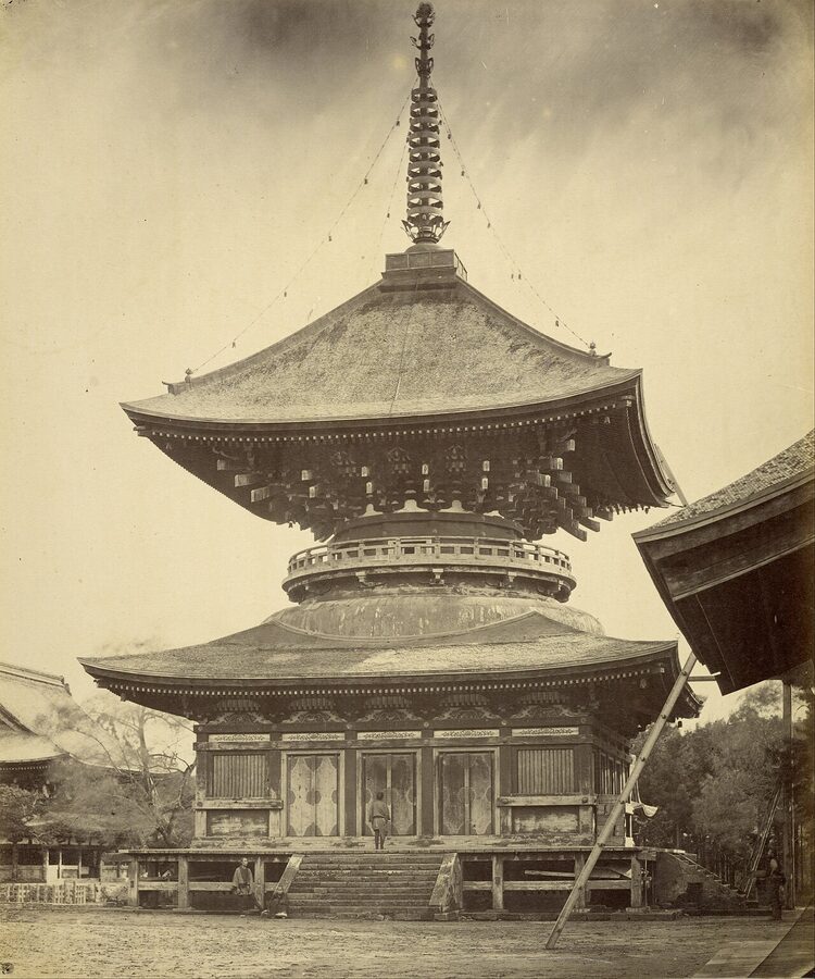
That separation, part of the Meiji Restoration‘s campaign against Buddhism, did more damage than any medieval murder. The shrine-temple had twenty-five monks’ lodgings on the hill; afterwards the pagoda, sutra library and Buddha halls went, and the guardian kings from its gate ended up at Jufuku-ji. You are looking at half of it.
A Buddha without a building
The Great Buddha began as wood. On the 23rd day of the third month of 1238, the Azuma kagami records, work started on a Buddha hall at Fukasawa, the valley west of the town, paid for by a monk called Jōkō who had begged for it from “high and low” across the country. A traveller who passed in 1242 found the hall and its Buddha two-thirds done and noted that the statue was wooden. It was dedicated on the 16th day of the sixth month of 1243.
Then, on the 17th day of the eighth month of 1252, the chronicle says that casting began at Fukasawa on a gilt bronze image eight jō high, which it calls a Shaka. Since the bronze is an Amida, Japanese scholars read “Shaka” as a slip of the brush and take this to be the statue you see. Nothing records when it was finished, who designed it or what happened to the wooden one, though the consensus is that it was lost and replaced rather than used as the model. Of Jōkō himself almost nothing else is known, and nobody believes one fund-raising monk paid for 121 tonnes of bronze; the Hōjō must have been behind it, even if the chronicle never says so.
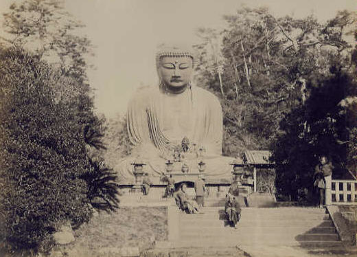
The Buddha is the second biggest in Japan after the one at Tōdai-ji in Nara: about 11.3 metres to the top of the head, or 13.35 with the pedestal, cast in some 40 separate pours that you can trace as a grid of seams on the inside. The bronze is unusually rich in lead, 19.6 per cent against 68.7 copper and 9.3 tin in the samples analysed during the 1959 to 1961 repairs, and some Japanese researchers think the casters melted down imported Chinese coins. It was covered in gold leaf, and traces still show on the cheeks. I am fond of the evidence that it had no proper name: in 1268, when the firebrand monk Nichiren wrote to Kamakura’s great temples warning of a Mongol invasion, every letter went to a named temple except this one, which he addressed to “the steward of the Great Buddha hall”.
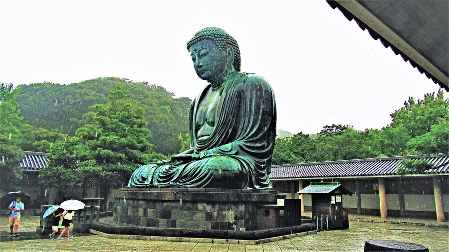
Now the tsunami, the story every guide tells. It goes that a great wave swept up the valley in 1498 and carried the Buddha hall away, and the temple’s own site gives the destructive storms and the earthquake as 1334, 1369 and 1498. Here is what is documented. The Taiheiki, the great war chronicle of the 14th century, says the hall was blown down by a gale in 1335; a later chronicle, the Kamakura ōnikki, says it collapsed again in 1369, and it also mentions a tsunami, which it dates to 1495; that was long assumed to be a slip for the great Meiō earthquake of 1498, though seismologists now think there was an earlier quake as well.
Then there is the poet-monk Banri Shūku, who came through in 1486, twelve years before the wave everyone remembers, and wrote that the Buddha sat in the open with no hall at all, and that people were gambling inside it in broad daylight. Excavations around the statue in 2000 and 2001 found no sign that the hall was ever rebuilt after 1369. So by my reading the wave may well have come up the valley, but it had no building left to take; what is documented is two collapses in the 14th century and a Buddha already roofless and full of gamblers by 1486.
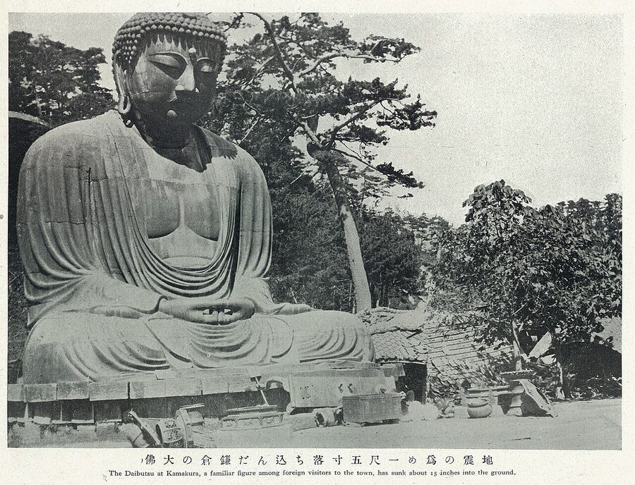
For two centuries nobody looked after it much. John Saris and Richard Cocks, English visitors in 1613 and 1616, found it neglected, and the Genroku earthquake of 1703 dropped its stone base by about three shaku. The rescue came from Yūten, later abbot of Zōjō-ji in Edo, and an Asakusa merchant, Nojima Shinzaemon, who in 1712 paid for repairs and a new hall for the monks and gave the temple his own Buddhist name, Kōtoku-in. In the decades that followed, the temple’s monks went begging through the streets of Edo to pay for further repairs.
In the 1959 to 1961 repairs engineers set the statue on a base designed to slide in the next earthquake, and weighed it: 23 jacks lifted it 55 centimetres, it was weighed twice, and the average was 121 tonnes. When conservators cleaned the inside in 2016 they found chewing gum and graffiti.
The poet Yosano Akiko wrote a famous verse about the statue, roughly “Kamakura: Buddha though he is, Shakyamuni is a handsome man, among the summer trees”. A stone carved with it stands in the temple grounds, put up in 1952 by the makers of a well-known brand of monosodium glutamate. As every guide points out, it names the wrong Buddha. I like the poem anyway.
Five minutes’ walk down the hill, Hase-dera (長谷寺) keeps the other giant of the Hase valley, a gilded wooden eleven-headed Kannon 9.18 metres tall. The temple’s story is that in 721 a monk carved two Kannon from one great camphor tree, kept one at Hase-dera in Nara and threw the other into the sea, and that it washed up on the Miura peninsula fifteen years later. The first solid evidence of the temple is less romantic: a bronze bell inscribed in 1264, which calls it the “new Hase-dera”.
Monks from Song China
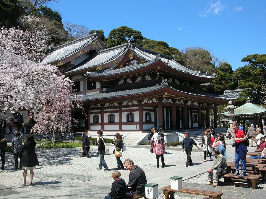
The Hōjō regents kept their estates in Yamanouchi, the valley north of the Kobukurozaka cutting, and it was there, technically outside the old town, that they built the great Zen monasteries: Kenchō-ji in 1253 under a Chinese abbot who spoke no Japanese, and Engaku-ji in 1282 for the dead of the Mongol invasions, on both sides. Their story is told in my piece on Zen Buddhism; what matters for the town is what they did to the hills.
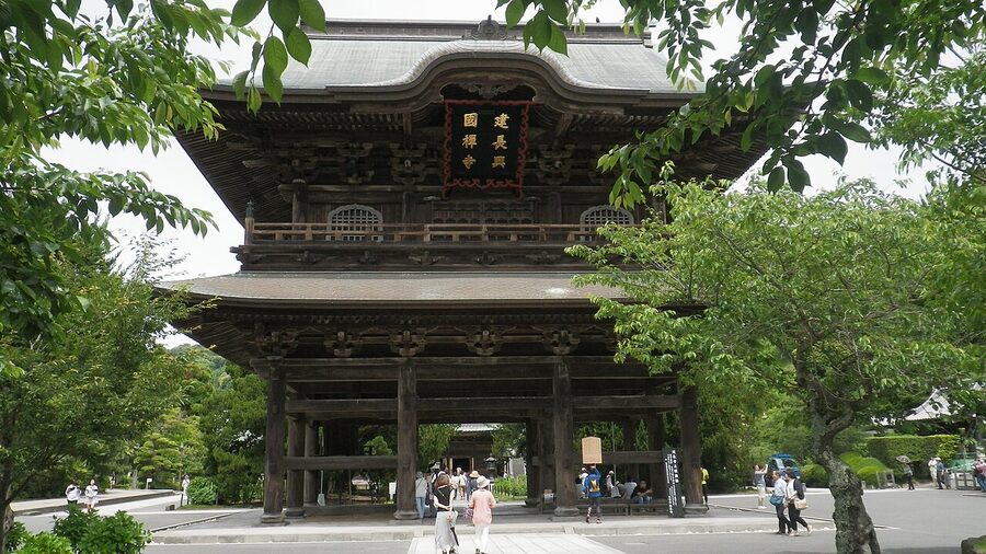
The Song monastery plan wanted a long, level axis, and Kamakura’s valleys had none to spare, so the builders cut the hillsides back into vertical walls to make room and dug cave tombs into the cliffs they had made. By the 14th century five of these houses were ranked as the Kamakura Five Mountains: Kenchō-ji, Engaku-ji, Jufuku-ji, Jōchi-ji and Jōmyō-ji.
The town drew craftsmen too. Its swordsmiths of the late 13th and early 14th centuries, the Sōshū school, are remembered above all for Masamune, traditionally said to have worked here, whose blades get their due in my piece on Japanese swords.
The tide at Inamuragasaki
The end came from the north-west, in the fifth month of 1333. Go-Daigo’s rebellion had been burning for two years in the west, kept alive by guerrillas like Kusunoki Masashige, and the shogunate’s own general Ashikaga Takauji had changed sides in the fourth month and taken Kyoto early in the fifth. In the east a minor lord of the Minamoto line, Nitta Yoshisada, raised his banner in Kōzuke, beat the Hōjō armies at Bubaigawara and marched down the Kamakura road.
He attacked the cuttings in three columns. On the Kobukurozaka side the regent himself, Akahashi Moritoki, led a force out to meet the attack at Susaki and killed himself there when it broke; at Kewaizaka Nitta’s main force made no progress; and at Gokurakuji-zaka, the western way in, the commander of the attack, Ōdachi Muneuji, was killed. The hills, for once, worked.
So Nitta went round them. The western approach was blocked by the cape of Inamuragasaki, whose cliffs then fell straight into the sea. According to the Taiheiki, on the 21st day of the month Nitta prayed to the dragon god of the sea and threw his sword into the waves, and the tide drew back and left a dry beach for his army to ride along into the city.
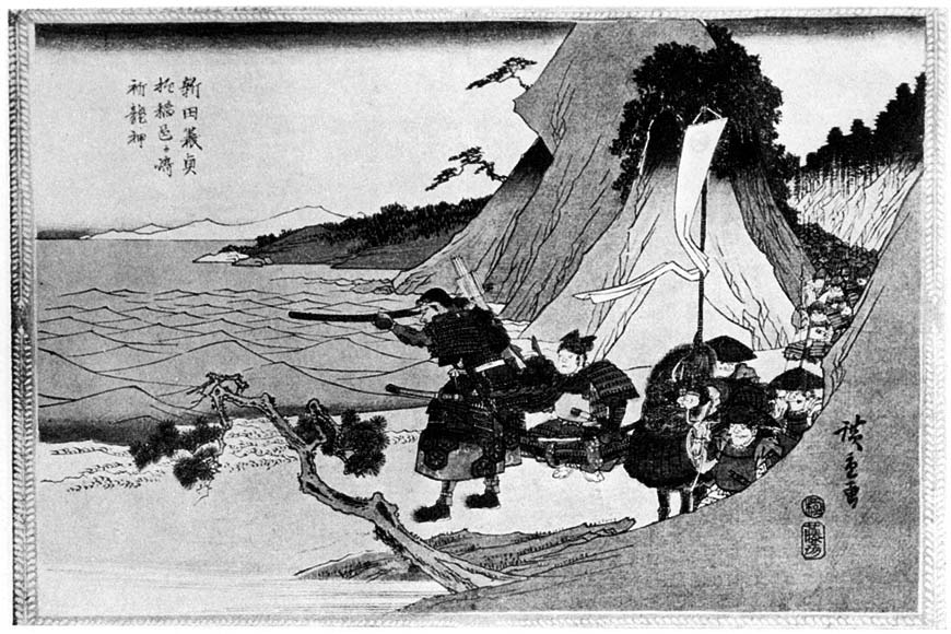
It is a wonderful story, and the tide part is probably true. Modern calculations of the tides for those days put the very low water not on the 21st but on the 18th, which suggests the chronicle got its date wrong rather than its tide. I have stood on that beach at the bottom of a spring tide, and the rock shelf that comes out of the sea is wide enough to ride a horse along, if you are not too particular about the horse.
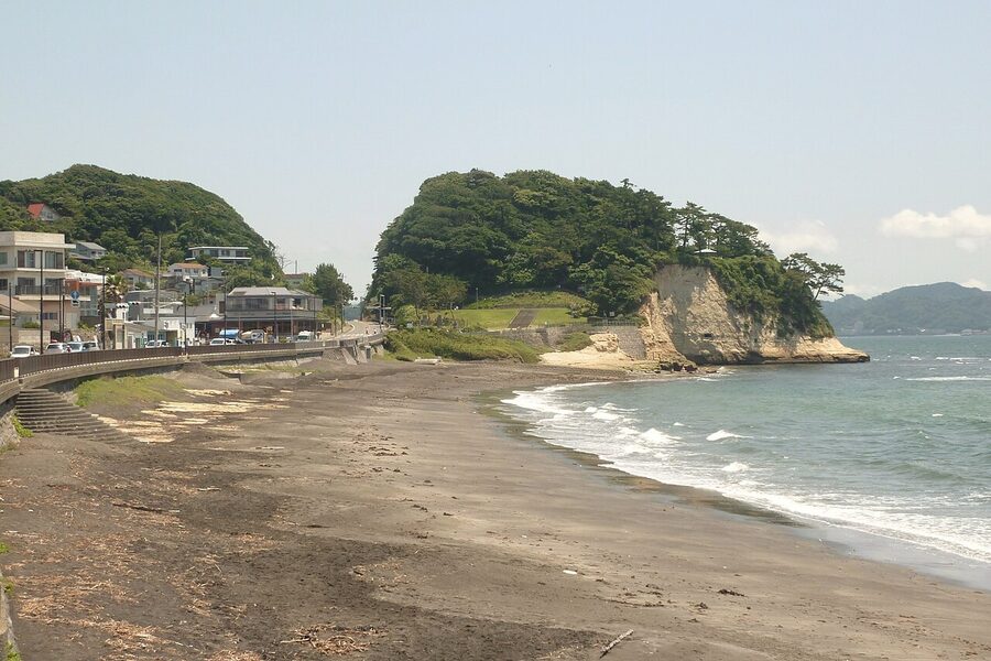
The fighting went on through the streets, and on the 22nd day of the fifth month the last senior Hōjō, the former regent Hōjō Takatoki, retreated with his family to their clan temple, Tōshō-ji, in a valley behind his mansion east of the shrine. There they set the temple on fire and killed themselves. The Taiheiki lists 283 men of the Hōjō and their household, and more than 870 in all with the warriors who followed them; Japanese historians allow for literary inflation, but the essential event is not disputed. Excavations in the 1970s and 1990s found the burned layer and imported Chinese incense burners and tea bowls of the kind only very rich men owned.
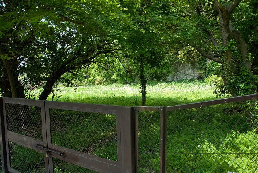
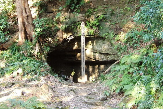
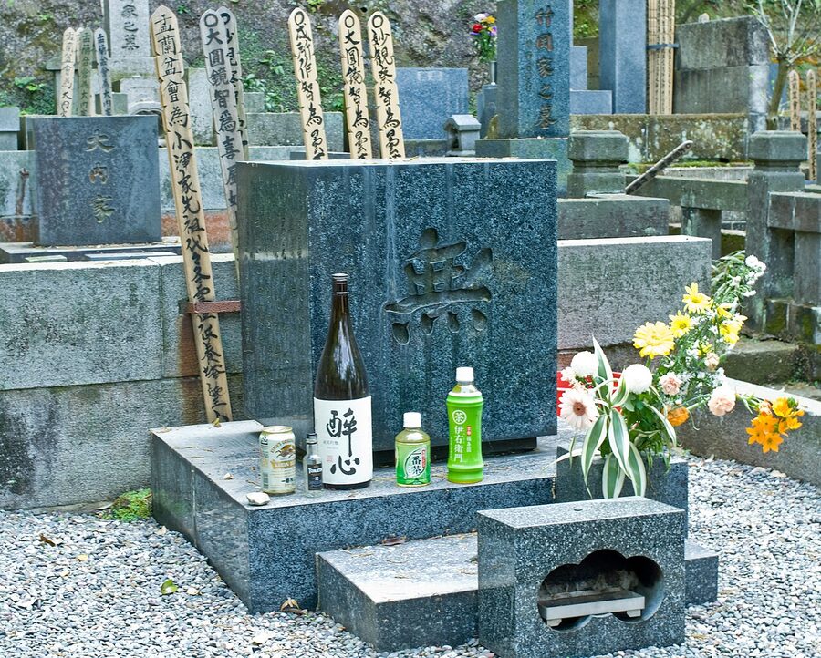
Above the site is a cave the locals call the Harakiri yagura, the place where tradition says Takatoki died; the regent’s end is the grimmest scene in my piece on seppuku. When it was excavated, archaeologists found roof tiles stamped with the Hōjō’s triple-scale crest but no bones. Memorial services are still held in front of it, and people leave tall wooden grave-tablets there.
Where the bodies went has been argued over since 1953, when the anthropologist Suzuki Hisashi of the University of Tokyo began digging a site in Zaimokuza near the first torii and brought out skulls and bones in their hundreds, many with cut marks, which he linked to the battle of 1333. Accounts of the count vary from about 550 to more than 900 individuals, depending on who is counting what. The university museum that keeps them cautions that not every injury can be read as a battle wound.
The sand dunes along the beach were the town’s graveyard for centuries. When a car park was dug under the seaside park at Yuigahama between 1995 and 1997, excavators found about four thousand skeletons, mostly of the late 14th and early 15th centuries and almost none with sword cuts: people who died of disease and disaster. Their average age at death was 24. In one corner the skulls of horses, cattle and dolphins had been laid out in an L, all facing the sea.
The better-off were buried in the hills instead, in yagura (やぐら), rectangular caves cut into the soft local sandstone from the mid-13th century to the 15th. The city’s board of education counts more than three thousand. Most now look like damp holes in the rock, but when new ones are found sealed they turn out to have been plastered white inside, sometimes with painted decoration, and filled with stone pagodas and cremated bones; one in the Nishimikado valley has fifty red rafters painted on its ceiling. The word itself is first recorded in 1685, as local slang for a cave.
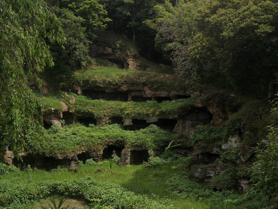
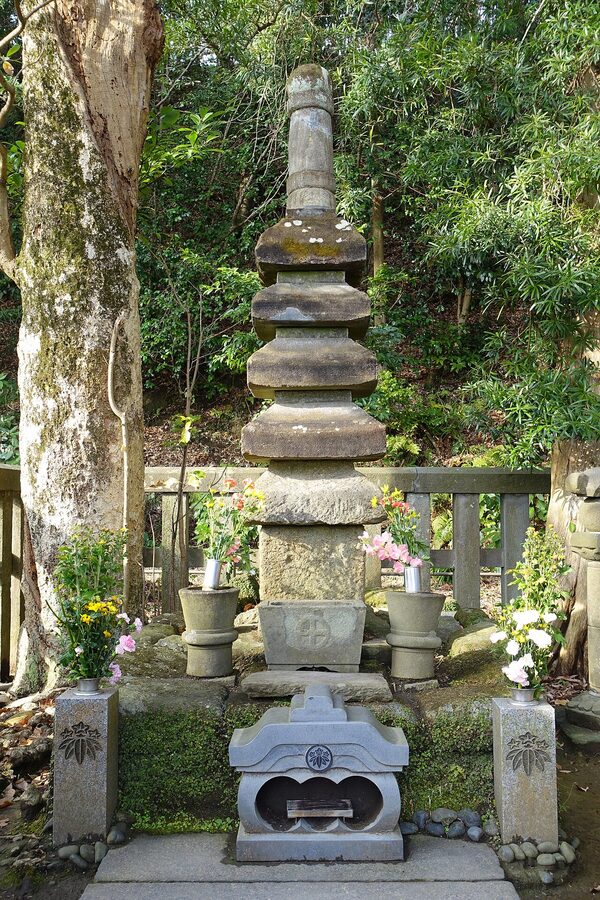
Yoritomo himself did not get a cave. He died on the 13th day of the first month of 1199, after a fall from his horse that the chronicles never quite explain, and was buried in his private Buddhist chapel, the Hokkedō, on the hill behind his residence. That much is documented. The five-tiered stone pagoda you find up the steps behind Shirahata Shrine is another matter: it was put in order in 1779 by Shimazu Shigehide, lord of Satsuma, whose family claimed descent from Yoritomo through an illegitimate son, a claim that most historians regard with polite scepticism.
Shoguns of the east, and a town gone to seed
Kamakura did not die in 1333; it changed hands. Takatoki’s son briefly retook it in 1335, Takauji came east to drive him out, and in 1349 the Ashikaga sent Takauji’s son Motouji to rule the east from here. The office he founded, later called the Kamakura kubō (鎌倉公方), governed ten provinces from Kamakura for a century, and its holders thought of themselves as shoguns in all but title. Contemporaries sometimes spoke of the two branches together as the shogunal houses of the capital and the country, which tells you how the eastern one saw itself.
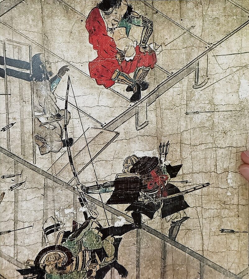
The kubō were trouble from the start, forever plotting against their cousins in Kyoto, and in 1438 the fourth of them, Ashikaga Mochiuji, broke with his own deputy, Uesugi Norizane, and with the shogun. On the 10th day of the second month of 1439, cornered at Yōan-ji in the eastern valleys, he killed himself. His son Yoshihisa did the same at Hōkoku-ji, the temple with the bamboo grove that every visitor now photographs.
The office was revived for Mochiuji’s surviving son, Shigeuji, and in 1455 he too fell out with Kyoto and fled to Koga, north of modern Tokyo. That was the end of Kamakura as a capital, and the end of the eastern half of the Muromachi order. The war that followed, the Kyōtoku war, began more than a decade before the Ōnin War and in the east it is a better date for the start of the Sengoku era; it was in those years, in 1457, that the Uesugi’s steward Ōta Dōkan built the castle around which Kawagoe grew. In 1526 a raiding fleet from across the bay burned Tsurugaoka Hachimangū, and the new power in the region, the Hōjō of Odawara, who had borrowed the old regents’ name, rebuilt it in 1540.
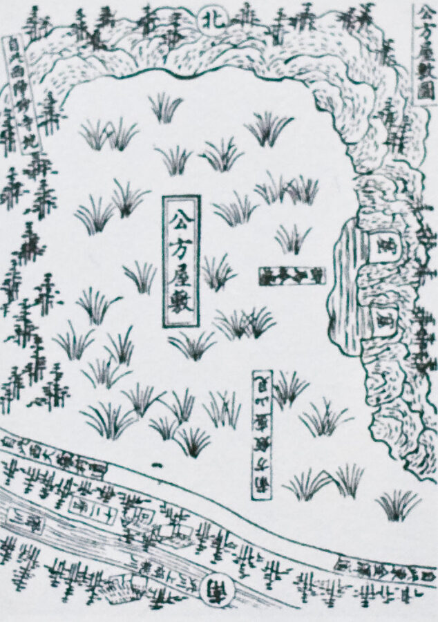
By 1600 Kamakura was a farming and fishing village with a few craftsmen, a lot of temples and a famous name. It was saved, after a fashion, by tourism. Tokugawa Ieyasu admired Yoritomo and read the Azuma kagami, and the shogunate of the Edo era paid to repair the shrine and the temples he had founded. Mitsukuni’s guidebook of 1685 numbered and named the sights, the seven entrances, the ten bridges and the ten wells, and the people of Edo began to come down for a few days, usually on the way to the island shrine at Enoshima or the mountain at Ōyama.
Edmond Papinot’s dictionary of Japanese history and geography, published in 1910, gave the population as 7,250 and summed the place up in one line: of the splendour of the past there remained only the famous Daibutsu and the Hachiman shrine. He was a little unfair, but only a little.
Sea air, a railway and the Kamakura writers
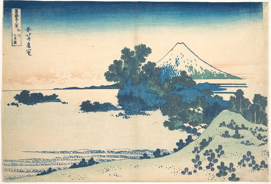
The modern town was made by doctors and a railway. In 1880 Erwin Bälz, the German physician who taught medicine in Tokyo, recommended the beach at Shichirigahama as the ideal place to recover your health, and the head of the government’s sanitary bureau, Nagayo Sensai, began to promote sea bathing, an idea most Japanese then found eccentric. A Western-style sanatorium opened by the beach in 1887. On 16 June 1889 the Yokosuka railway line opened with a station at Kamakura (English-language accounts often say 1890), and Tokyo was suddenly two hours away.
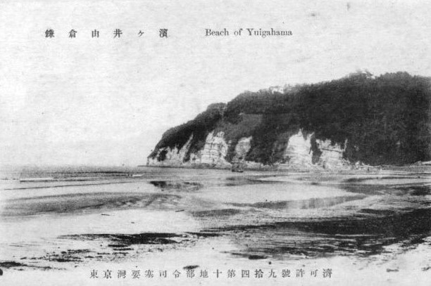
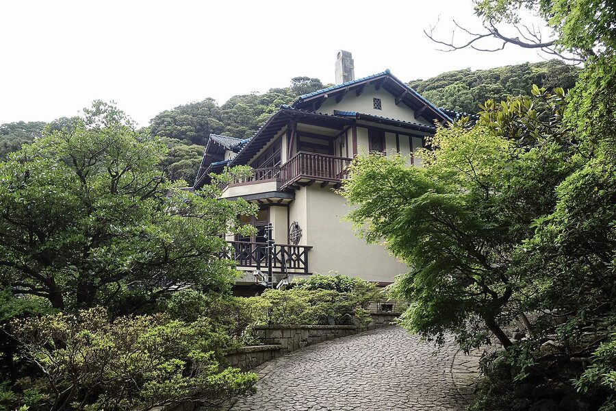
The railway cut through the dankazura, villas went up in the valleys, and in 1899 the imperial household built a seaside residence. The little Enoshima Electric Railway, the Enoden, reached Kamakura in 1910, and once the Tokyo line was electrified in the 1920s the old backwater became a commuter town for people who could afford not to live in Tokyo.
The writers came early. Natsume Sōseki spent the turn of the year 1894 to 1895 sitting zazen at Engaku-ji under the abbot Shaku Sōen, failed to reach enlightenment, and put the failure into his novel The Gate (門) in 1910. His Kokoro of 1914 begins on the beach at Kamakura, where the narrator first sees the older man he calls Sensei among the summer bathers. Akutagawa Ryūnosuke lodged by the beach in 1916 and 1917, and a young popular novelist took the pen name Osaragi Jirō from Osaragi, the old place name of the Great Buddha’s valley, which is written with the same characters as “Daibutsu”.
The Great Kantō earthquake of 1 September 1923, which began under Sagami Bay, wrecked the town: the shrine’s gate and dance stage fell, the temples collapsed, and a tsunami came up the beach. But Tokyo burned, and the disaster that ended the Taishō era‘s easy years sent more writers south. Kawabata Yasunari moved here in 1935 and lived in Hase from 1946 until his death in 1972; Kobayashi Hideo, Kume Masao and Satomi Ton were neighbours, and by the late 1930s the newspapers were calling them the Kamakura bunshi (鎌倉文士), the Kamakura literati.
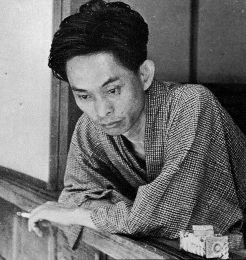
The war made them booksellers. On 1 May 1945, with paper rationed and publishing nearly dead, Kawabata, Kume, Takami Jun, Osaragi and others pooled their own libraries and opened a lending library, the Kamakura Bunko, on the street to the shrine. It grew into a publishing house after the surrender. Kawabata’s Thousand Cranes opens at a tea gathering at Engaku-ji, the sort of scene my piece on the tea ceremony describes in more forgiving terms.
The film director Ozu Yasujirō set Late Spring (1949) in Kamakura and Early Summer (1951) in Kita-Kamakura, and in May 1952, after a fire at the Shōchiku studios at Ōfuna where he worked, he moved to Kita-Kamakura with his mother for good. He died on 12 December 1963, his sixtieth birthday. The Shōwa Kamakura of his films, the quiet houses, the trains and the women who will not marry, is still recognisable in the lanes behind Engaku-ji, if you get there before the coaches.
The writers also saved the hills. In 1964 a developer began to clear the wooded valley behind the shrine for housing, and Osaragi, Kobayashi, the Zen scholar Suzuki Daisetsu and the abbot of Engaku-ji led the campaign that stopped it. The row led to the 1966 law protecting the historic scenery of Kamakura, Kyoto and Nara, which is why the ridges here still carry trees rather than apartment blocks.
The bid that ICOMOS turned down
Kamakura went on Japan’s tentative list for World Heritage in 1992 and watched Kyoto, Nikkō, Hiroshima and Hiraizumi go through ahead of it. When it was finally nominated, as “Kamakura, Home of the Samurai”, ICOMOS sent inspectors in September 2012 and on 30 April 2013 recommended that it not be inscribed at all, the lowest of the four possible verdicts. It was the first time a site nominated by Japan alone had been graded so badly, and on 4 June the government withdrew the bid to avoid a formal rejection.
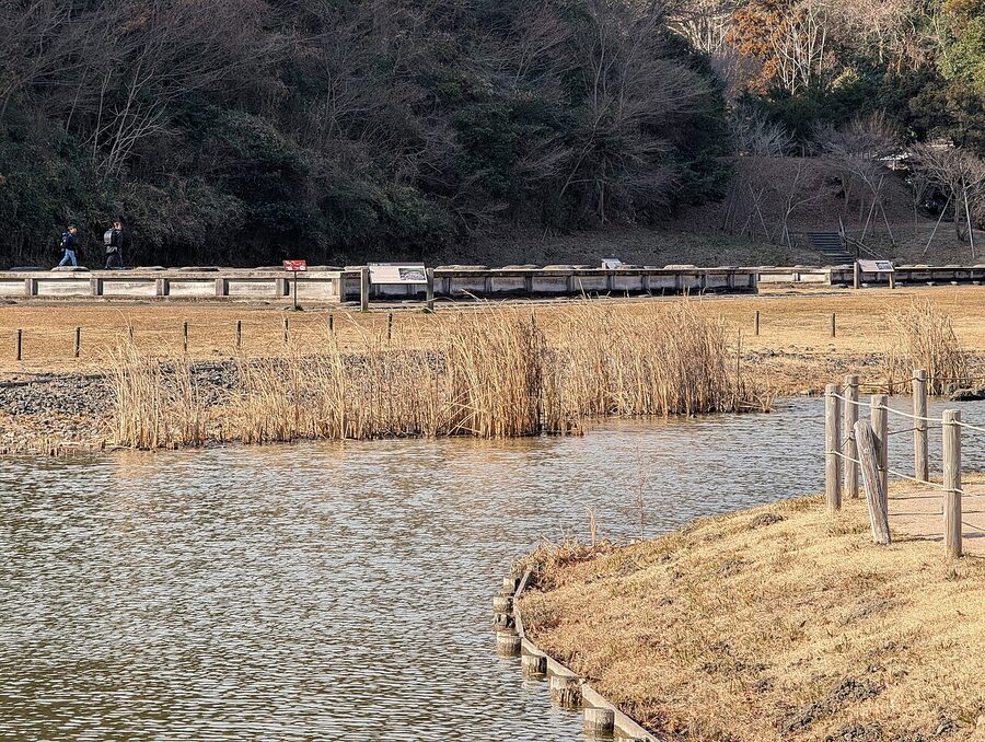
The reasoning was blunt. The nominated properties were temples, shrines, cuttings and a harbour, and ICOMOS found that they did not show the city itself, its planning, its trade and the daily life of the samurai capital the title promised. Japanese critics went further: not one of the four sites where the shoguns actually lived has been located even archaeologically, and most of the temple buildings are Edo-period or later rebuilds.
I think the inspectors were right, and that it hardly matters. The Kamakura of 1252 is mostly underground, under 1.8 metres of fill on Wakamiya-ōji and four thousand skeletons in a car park, and the town on top is a Meiji resort with a medieval street plan. Work on a new nomination was suspended in 2019; I would not hold my breath, but I would still go.
Where to see Kamakura today
Kamakura is just under an hour from Tokyo Station on the JR Yokosuka Line, which also stops at Yokohama, and the Shōnan-Shinjuku Line brings you from Shinjuku. Get off at Kita-Kamakura for the Zen temples and Kamakura for everything else; they are one stop apart, and the walk between them through the Kobukurozaka cutting takes about twenty minutes. Hours and prices below come from each place’s own site and were checked on 16 November 2026.
The trouble with Kamakura is that everybody knows it. At weekends, in cherry and hydrangea season and on public holidays, Komachi-dōri, the shopping street beside Wakamiya-ōji, is a slow-moving queue and the Enoden platforms can hold you up for half an hour. The tourism association runs a live crowd map; on a weekday in winter you will wonder what everyone was complaining about.
Getting around: the Enoden
The Enoden runs from Kamakura Station along the coast to Fujisawa, and the stops that matter are Hase, the third, about seven minutes out, for the Great Buddha and Hase-dera, and Inamuragasaki, for the cape. The day ticket, Noriorikun, costs ¥800 for adults and ¥400 for children and pays for itself after three or four rides. The famous level crossing by the sea at Kamakura-Kōkōmae, the one from the basketball cartoon, is a tourist attraction in its own right, and the neighbours would like you to stand back from the tracks.
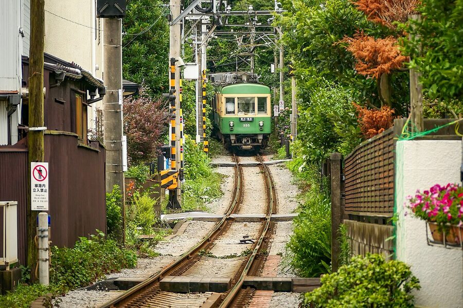
Day one: Kita-Kamakura, the shrine and the Buddha
Start at Kita-Kamakura Station at 8:30, when Engaku-ji opens; from March to November it stays open until 16:30 and from December to February until 16:00, and admission is ¥500. Find Ozu’s grave, then walk down the main road to Kenchō-ji, also ¥500 and open 8:30 to 16:30. Their zazen sessions are listed in my Zen Buddhism piece, and half an hour on a cushion beats half an hour in the souvenir shops.
From Kenchō-ji follow the road through the Kobukurozaka cutting, one of the three fronts of 1333, and come down into the back of Tsurugaoka Hachimangū. The shrine’s gates are open from 6:00 to 20:00 every day of the year and there is no charge. Climb the 61 steps, look at the ginkgo stump, and come down past the ponds to the Kamakura Museum of National Treasures on the east side.
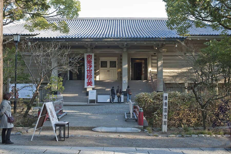
The museum opens from 9:00 to 16:30, with last entry at 16:00, and closes on Mondays (or the next weekday after a public holiday). Admission depends on the exhibition; until 6 December 2026 the special show marks seven hundred years of Zuisen-ji, the eastern valley temple with a rock garden attributed to Musō Soseki, whose wider story is in my piece on Japanese gardens.
Walk down the dankazura to the second torii, turn right for Kamakura Station and take the Enoden to Hase. If you are hungry, eat now: Kōtoku-in forbids eating and drinking anywhere on its grounds, bottled water excepted.
Kōtoku-in and Hase-dera
Kōtoku-in is seven minutes’ walk from Hase Station. From April to September it opens from 8:00 to 17:30 and from October to March from 8:00 to 17:00, with entry up to fifteen minutes before closing; admission is ¥300 for adults and ¥150 for children. For another ¥50 you can climb inside the statue between 8:00 and 16:30 and look at the seams of the castings from the wrong side, which is the best fifty yen you will spend in Kamakura.
Walk round the back. A pavilion from a Korean royal palace, given to the temple in 1924, stood there until 2024, when it was dismantled and sent home to Korea; the temple plans a new hall by about 2027. The big stones around the statue are the bases of the hall the Buddha lost.
Hase-dera is five minutes from Kōtoku-in. It opens from 8:00 with last entry at 16:30 and closes at 17:00, and from April to June it stays open half an hour longer; admission is ¥400. Go up past the Kannon hall to the terrace for the view over the bay to the Miura peninsula, and if you are here in June, expect to queue: the temple began planting the hydrangea path in the early 1990s and now has about 2,500 bushes of more than forty varieties, with timed tickets in the high season.
Finish the day on the beach at Yuigahama, a ten-minute walk downhill. In the evening the surfers come in, the sea goes pink behind Inamuragasaki, and the four thousand people of the Yuigahama burial ground lie quietly under the car park.
Day two: the eastern valleys
On a second day, go east from the shrine into the valleys where Yoritomo’s Kamakura really was. His grave is up the steps behind Shirahata Shrine at Nishimikado, a ten-minute walk from the shrine and free; the site of his residence, the Ōkura palace, is the residential street below, marked only by a stone monument. Hōkai-ji, built for the souls of the Hōjō on the site of their mansion, is on the way back towards the shrine and is famous for its bush clover in September. The restored site of Yōfuku-ji is a short walk further up the Nikaidō valley.
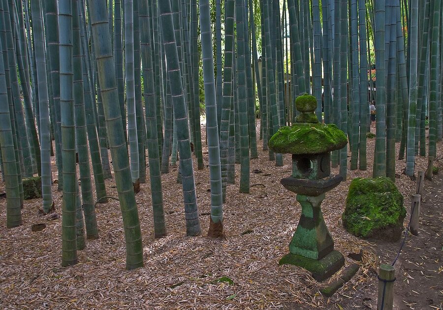
Further east, Hōkoku-ji is where Mochiuji’s son died and where everyone now photographs the bamboo. It opens from 9:00 to 16:00 and admission is ¥400; for another ¥600 you can drink a bowl of matcha in the little teahouse, served until 15:30. Go early, because the grove is small and the photographers are many.
For the end of the Hōjō, walk the Gionyama trail. It climbs from behind Yakumo Shrine in Ōmachi, which worships the same plague god as Kyoto’s Yasaka Shrine and gives the hill its name, follows the ridge with a view over the whole valley to the sea, and drops down beside the site of Tōshō-ji. It was closed after typhoon damage in 2019 and reopened on 1 April 2023; the city still warns of falling rocks near the Tōshō-ji site, and you cannot go up to the Harakiri yagura itself. Allow about forty minutes, and do not do it in the rain.
Then go down to the shore at Zaimokuza. At low tide, especially at the spring tides around the new and full moon, the boulders of Wakaejima stand out of the water for 200 metres off the eastern end of the beach, and you can see Yasutoki’s harbour much as the timber ships saw it. Check a tide table before you go; at high water there is almost nothing to see. Moto Hachiman, the original Hachiman shrine, is a few minutes’ walk inland.
The Daibutsu trail and Zeniarai Benten
If you would rather walk than ride between the two halves of the town, take the Kuzuharaoka and Daibutsu hiking trail. It starts beside Jōchi-ji in Kita-Kamakura, runs along the western ridge past Kuzuharaoka Shrine and Genjiyama park, where a statue of Yoritomo sits looking unimpressed, and comes down to Kōtoku-in: about three kilometres and an hour and a half by the tourism association’s reckoning. It is a forest path with roots and mud, and on a busy day the only quiet route between the Zen temples and the Buddha.
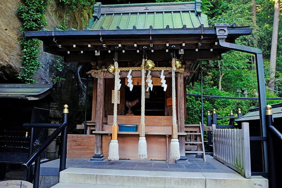
The longer Ten’en trail follows the northern ridge from Kenchō-ji round to Zuisen-ji; Kenchō-ji asks walkers who come through its grounds to pay the ¥500 admission like everyone else.
Seasons, flowers and festivals
The cherries along the dankazura flower in early April, when everyone in Japan is outside at once for reasons my piece on cherry blossom explains, and the Kamakura Matsuri in mid-April brings Shizuka’s dance and mounted archery to the shrine. The yabusame of the shrine’s great annual festival, on 16 September, is the one to see if you can only see one.
June is hydrangea month, and the queue for Meigetsu-in in Kita-Kamakura can stretch down the lane. The temple opens from 9:00 to 16:00 for ¥500, the hours change in hydrangea season, and the rear garden opens in June and November for another ¥500. Its hydrangeas are less ancient than the crowds might suggest: they were planted after the Second World War because there was no wood for fence posts along the approach and the bushes needed less looking after.
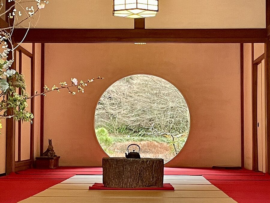
Autumn colour in the valleys comes late, at the end of November and into December, and winter is the best time of all: clear air, Fuji over the sea from Inamuragasaki, and the Zen temples to yourself on a weekday.
One jar per household
The town that counted its sake jars in 1252 has outlived every era in my walk through Japan through the ages without changing its character much. It is still crowded into its valleys, it still lives off people coming over the passes and along the coast, and it still has more temples than it strictly needs. The shogunate is gone, the Buddha has lost its hall, and the shrine has lost its Buddhists, but the road Yoritomo built for his wife’s pregnancy still runs straight from the shrine to the sea.
Walk it at the end of the day, down the dankazura, past the second torii and across the railway, to the beach where the boats used to tie up. Buy a drink on the way; there is no regent to break your jar. Just keep it off the grounds of Kōtoku-in.